Mt Sniktau Hike - Complete Trail Guide
The Colorado Local's Hiking Report
Everything You Should Know Before Hiking Colorado's Iconic 13'er: Mt Sniktau
Local Advice for Preparing to Hike Mount Sniktau
There are beautiful trails in Colorado, and then there’s Mt Sniktau: a 13’er hike that’s truly in a league of its own. As local Coloradans, we’ve done plenty of hikes all over the state, and the Mount Sniktau trail easily makes it into our top 3.
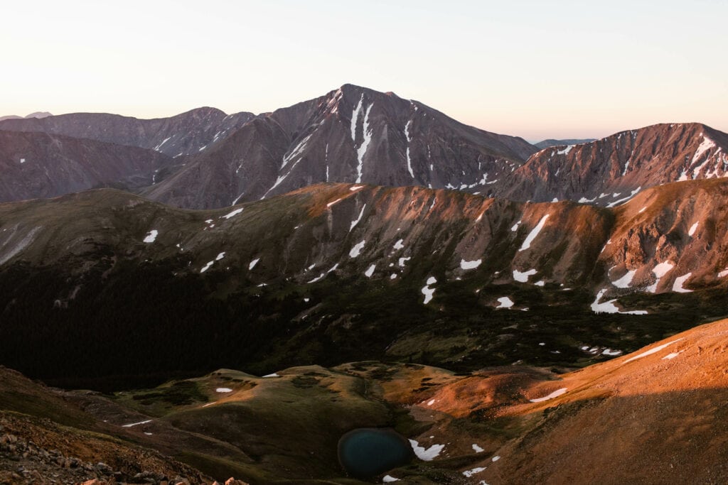
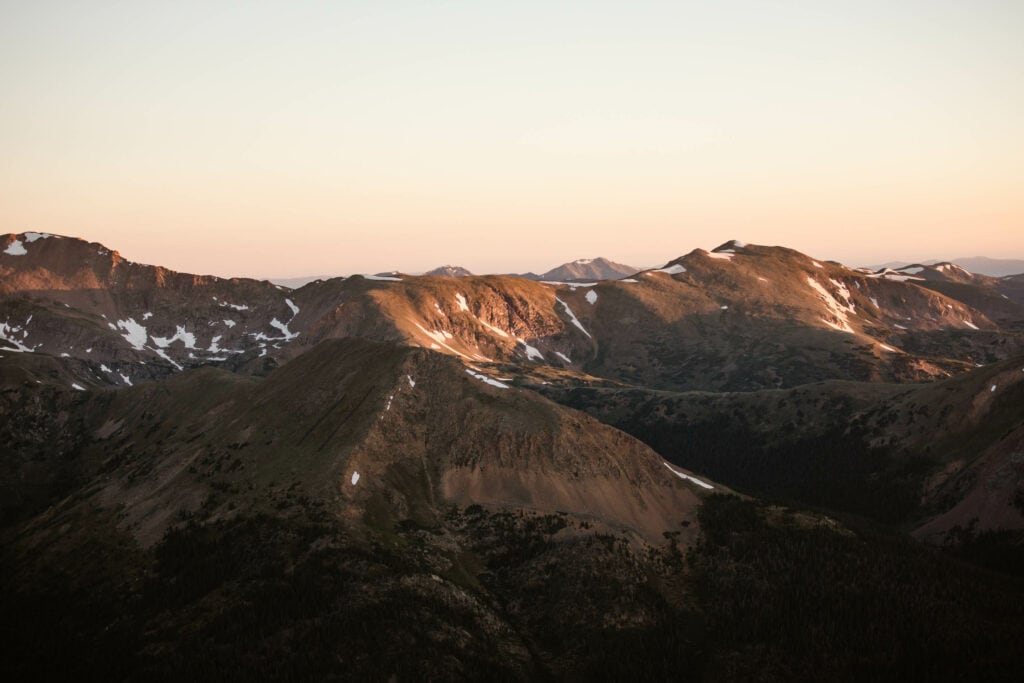
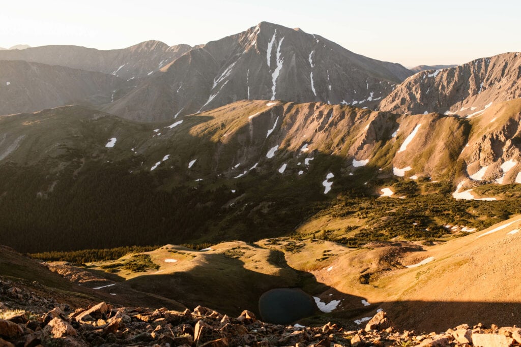
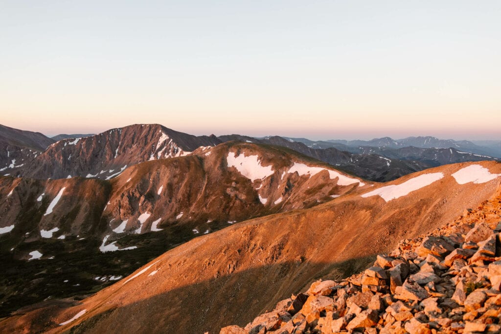
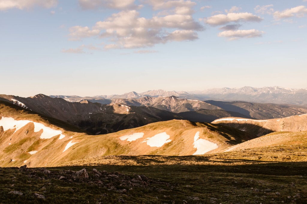
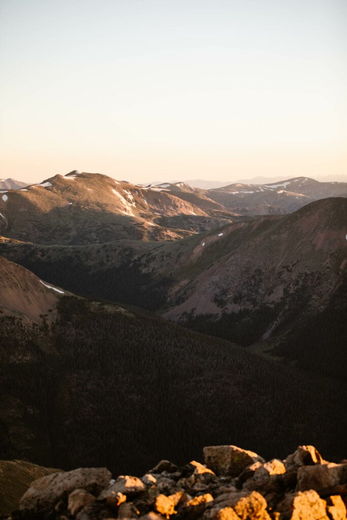
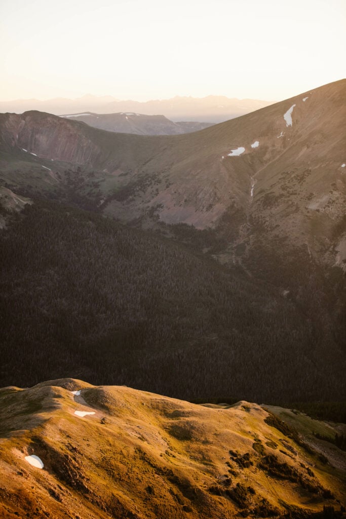
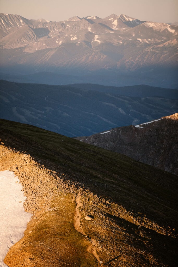
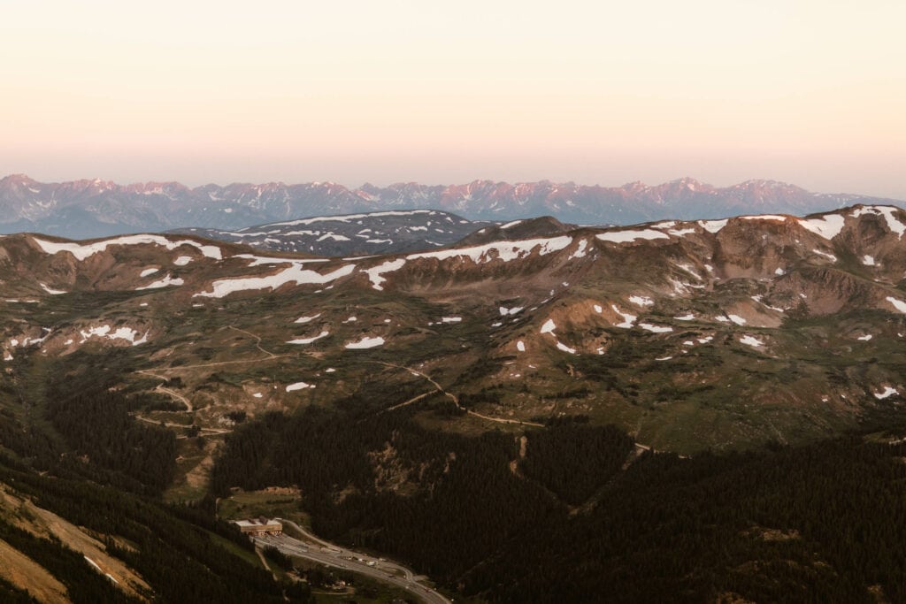
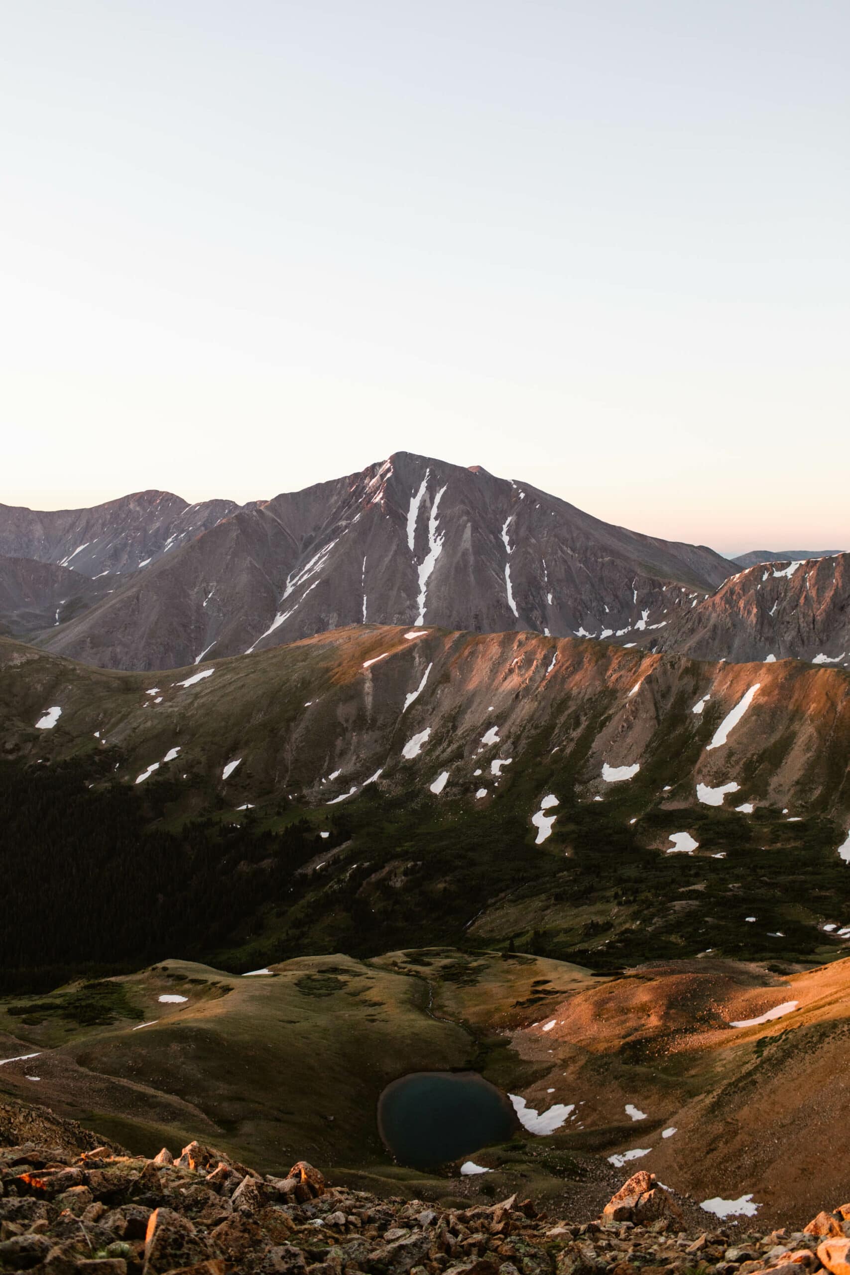
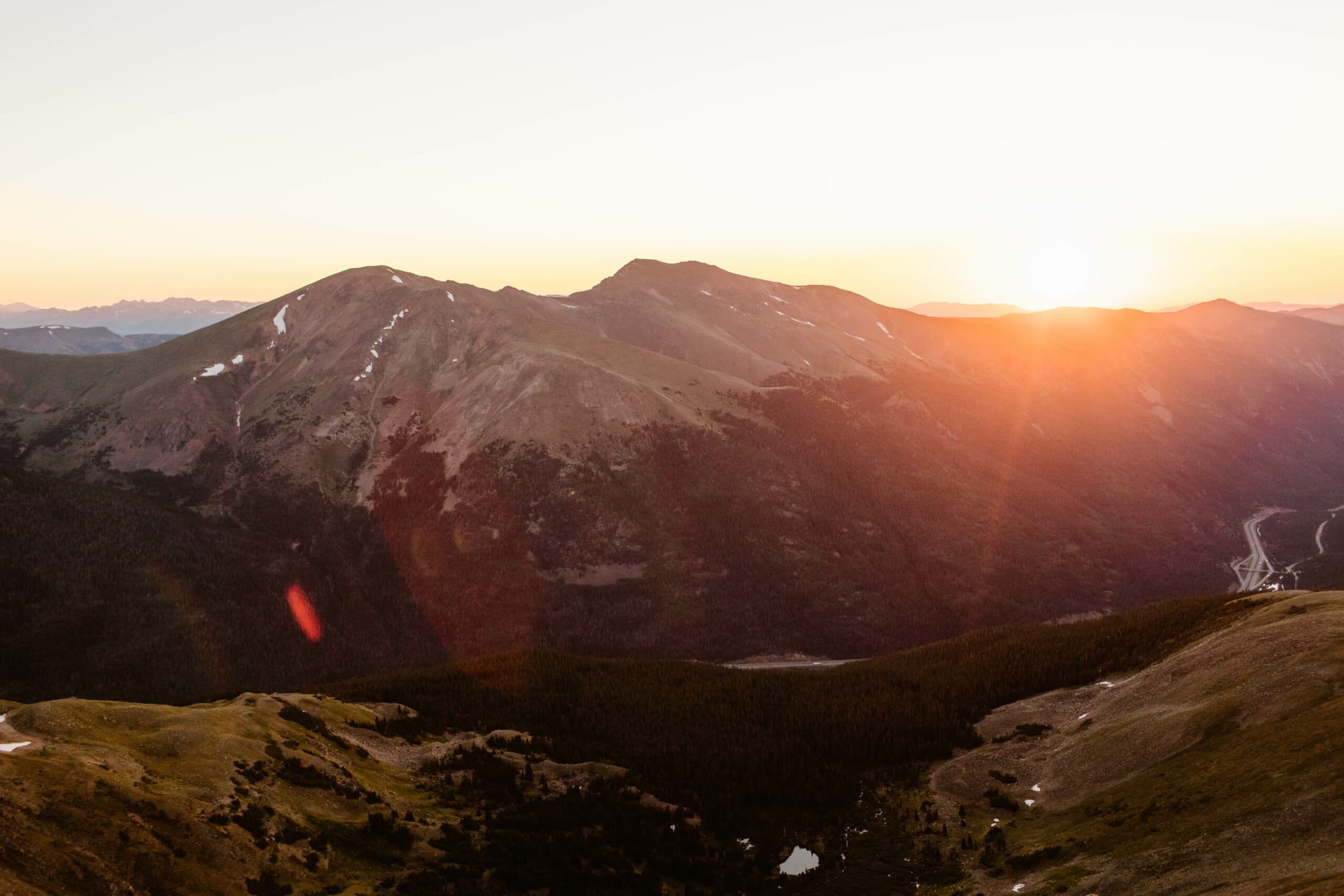
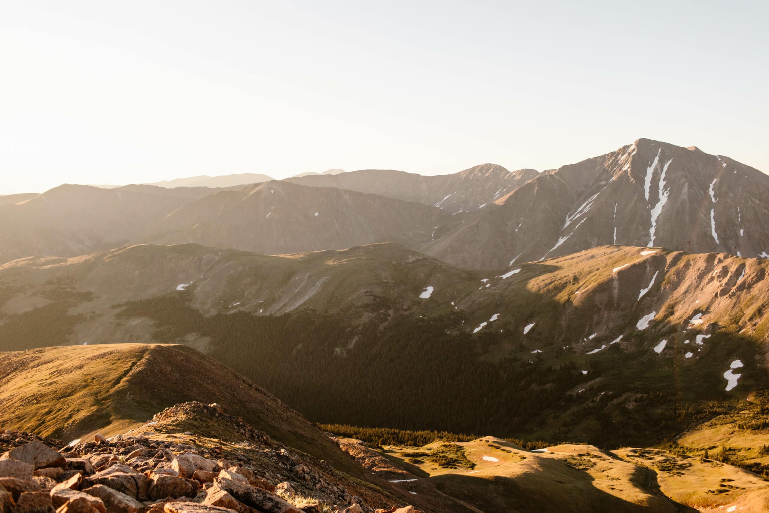
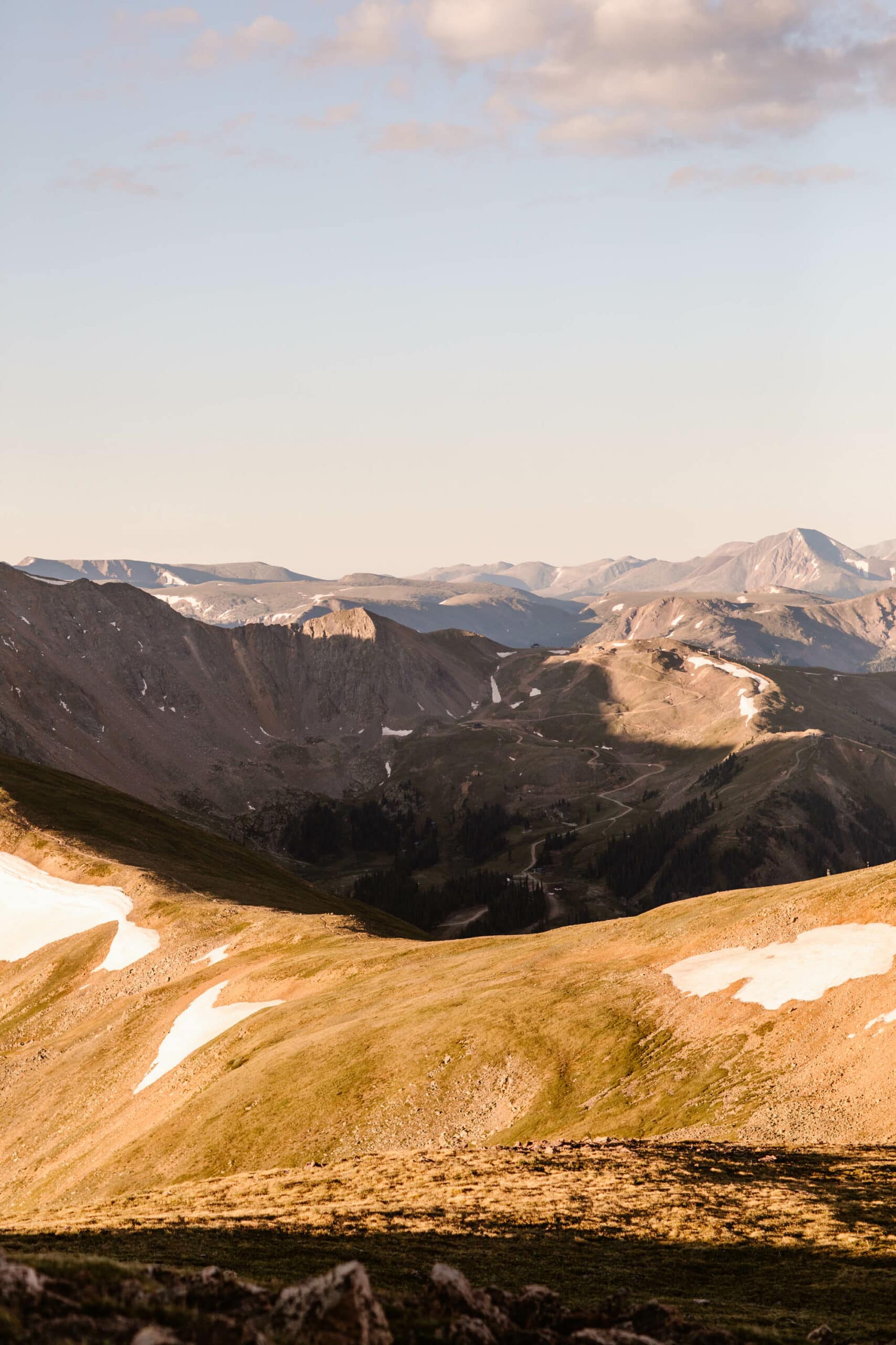
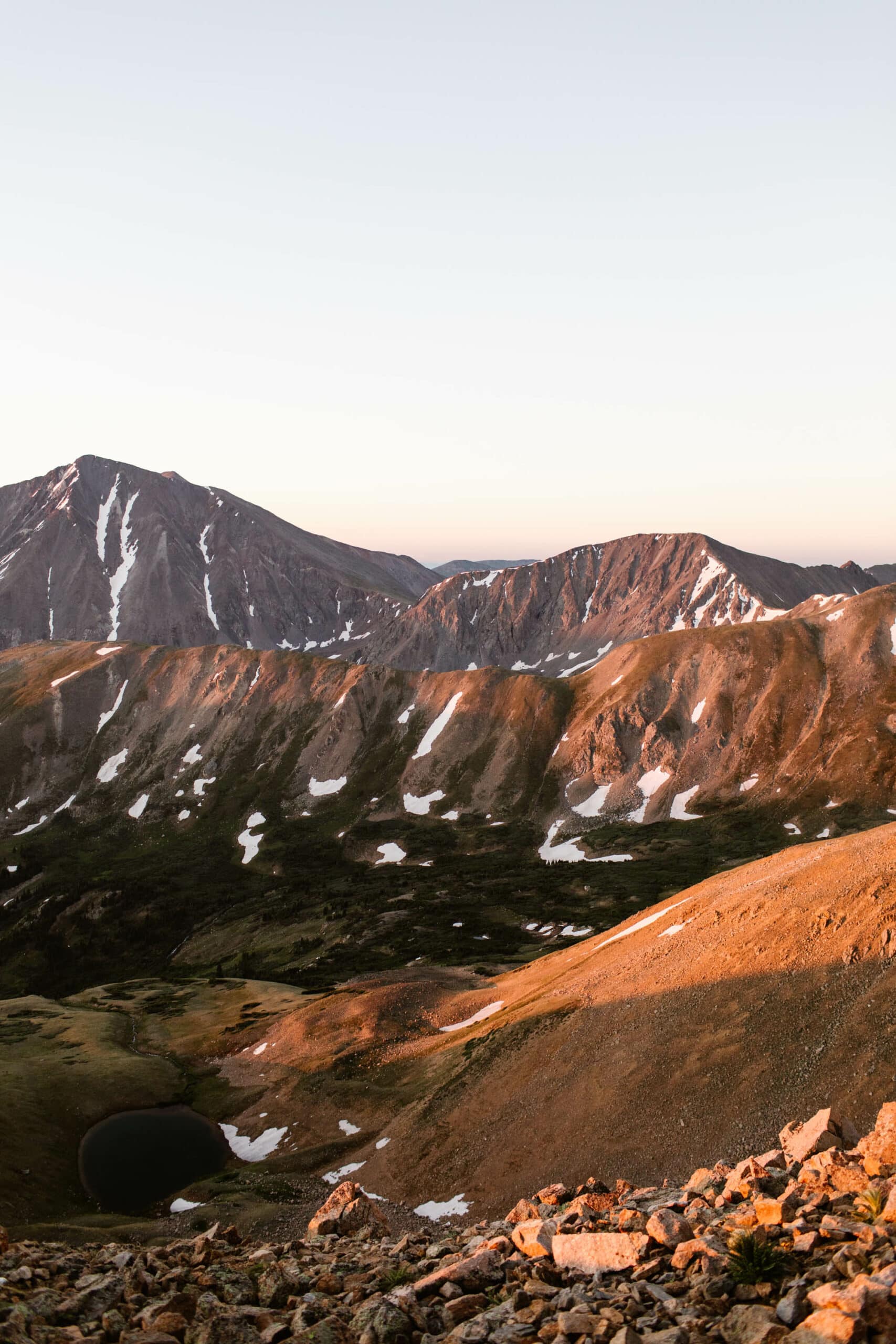
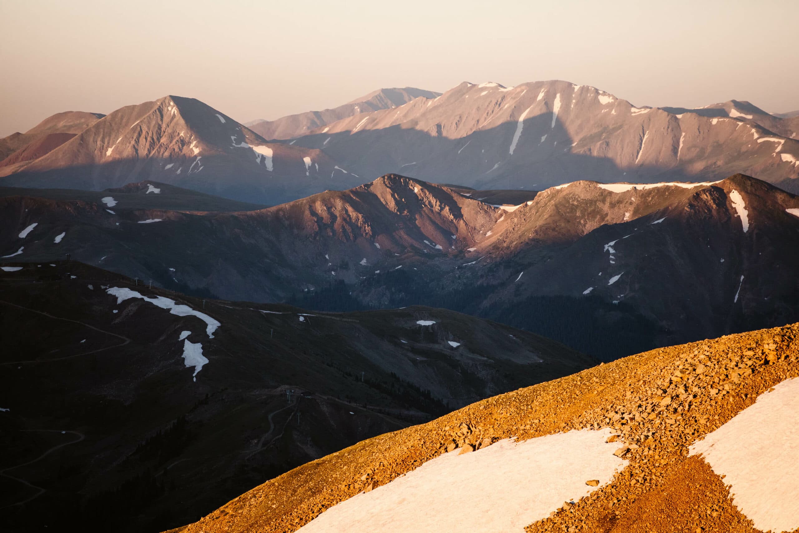
Sunrise at this spot literally feels like it came straight out of a painting. And the 360 degree mountain views you get at the summit? Well worth the steep and slippery trek.
The views are a 10/10, but the Mt Sniktau hike isn’t exactly the easiest one in the area. In our guide, we’ll break down everything you need to know about hiking Mount Sniktau, from the trail conditions to the best seasons to the ideal times of day and days of the week to hit up this dreamy spot.
And of course, no trail guide of ours would be complete without plenty of photos of our adventures on this trail. So without further ado, let’s get into it: the ultimate hike guide to Mt Sniktau trail.
Disclosure: We’ve included lodging near the Mt Sniktau hike and gear recommendations in this guide. If you choose to book or buy through our links, we may earn a commission, at no cost to you. Shopping through these links helps support our small Colorado business and allows us to continue creating this free content.
All recommendations in our Mt Sniktau hike guide are crafted with love and expertise, from platforms we use and trust for our own adventures, both in the Rockies and beyond.
Where in CO is the Hike to Mt Sniktau?
Directions to the Trailhead
The Mt Sniktau hike is super close to the Front Range, only a little over an hour’s drive from Denver. So if you’re in the Denver area and looking to get a dreamy 13er under your belt, the Mount Sniktau trail is a winner.
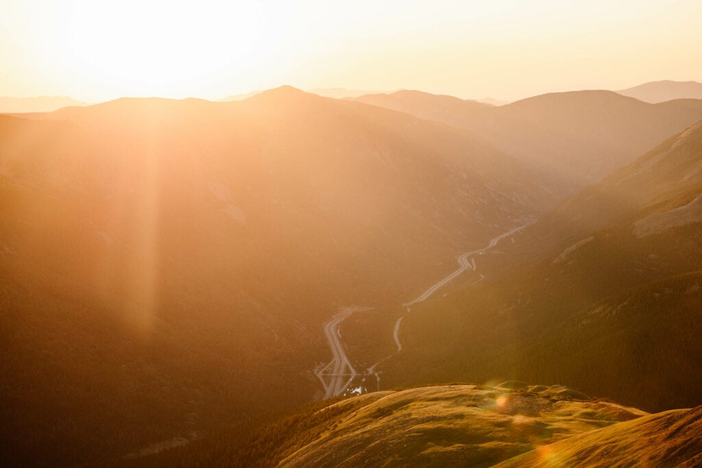
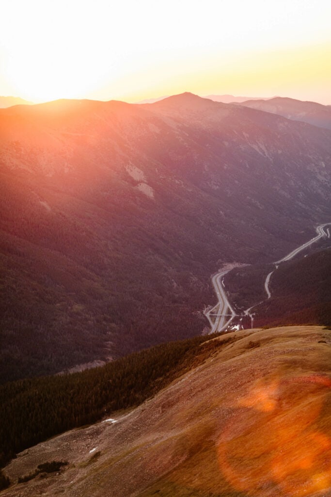
Most people that do the Mt Sniktau hike will be coming from i70. Whether you’re coming from the east or west, you’ll take exit 216 for US-6/Loveland Pass) and drive it to the summit (a little more than 4 miles), where you’ll see a parking area on your left (across the street from the Continental Divide elevation sign).
If you happen to be traveling from Keystone, you’ll take US-6 east for a bit over 10 miles until you get to the same parking lot up at the summit. But the Mt Sniktau hike parking lot will be on your right if you’re coming from this side.
- Mt Sniktau Hike GPS (parking lot): 39.663409, -105.878926
- Nearest Towns to Mt Sniktau Hiking Trail: Keystone and Dillon, Colorado
- Cell Service: Yes, but it can be spotty closer to the trailhead (we advise having an offline AllTrails map downloaded and bringing a satellite communication device like this brand we use when completing the Mt Sniktau hike)
When Is The Mt Sniktau Trail Open?
Hiking Seasonality on This Trail
The Mt Sniktau hike is open year-round, but given its location on the pass, you’ll want to keep an eye on inclement weather road closures, which can happen time-to-time outside of the summer season.
Driving in an AWD vehicle or having tire chains on you is highly recommended if you’re navigating to the trailhead in the colder months.
Generally speaking, we don’t advise summiting Mount Sniktau the winter, unless you have experience hiking steep trails in the snow and have avalanche training (as this is an avalanche-prone area).
And if you do opt for a winter hike, at the bare minimum, you’ll want to bring crampons (these are the ones we use on our winter adventures) to grip into the packed down snow and ice on your route to the summit of Mt Sniktau.
Before you attempt this hike, these are the must know stats about the Mt Sniktau trail:
- Trail Length: approx. 3.8 miles
- Elevation Gain: 1608 ft
- ADA Accessible: no
- Family Friendly: not recommended for young children
- Dog Friendly: yes (must be kept on leash)
- Fee: none
Is Mt Sniktau A Hard Hike?
Who Is This Trail Best For?
For anyone who isn’t acclimated to high alpine elevations or doesn’t regularly hike, the Mt Sniktau hike is absolutely a hard trail to do. It’s worth noting, we live in Colorado and hike multiple times a week, and we’d still qualify this trail as challenging.
The most difficult part is the first mile or so, where it’s an extremely steep and constant incline, with the trail ground made up of lots of loose, small rocks and sand.
As for bringing young kids along on the Mt Sniktau hike, we would advise against this (especially if your young ones are mobile and prefer not be in a carrier). We’ve never brought our kiddo on this one, and we plan to keep it that way.
Curious What Else is Around the Mt Sniktau Hike?
The Sniktau hike trailhead is located at the top of one of our favorite mountain passes near Denver. Loveland Pass is a local favorite year-round. It’s a go-to for snow sports in the winter and hiking in the summer. And we break down our must-see spots on this drive in our guide.
Essential Gear for the Mt Sniktau Hike
While Mt Sniktau is a shorter hike, from a miles-standpoint, there are a few crucial gear items you’ll still need. Note: this list is focused on doing this hike when there is no snow and ice (although, the gear recommendations still apply, even for then).
If you’re doing the Mt Sniktau hike in the winter, not only will you really want avalanche training, but you’ll also need crampons and/or snowshoes (depending on how packed down the trail is).
- Sunscreen – the whole trail to the summit of Mt Sniktau is above treeline, and you’re constantly exposed to the sun. Add to it the fact that the sun is more intense at higher elevations, and you have a super high risk of burning. This is the sunscreen we use religiously when hiking in the high alpine. They also have a face sunscreen that doesn’t leave any cast and never clogs pores (not gonna lie, this one is our obsession).
- Satellite Communication Device – Our Garmin comes with us on every trail, so we can ensure we can text for help or put out an SOS if we get injured. While we actually did have cell service with our provider (Verizon) on the Mt Sniktau hike, other providers don’t always get service here.
- Trekking Poles – A true essential. Yes, you could do the Mt Sniktau hike without them, but it’s pretty miserable without (we’re speaking from experience). The sharp incline (and slippery, sandy rock) during the first half of the trail is not fun without trekking poles. Get some lightweight aluminum ones. Your knees will thank you.
- Headlamp – Do not, we repeat, do not do the Mt Sniktau hike around sunrise or sunset without a headlamp. We talk about this later, but there’s a section of trail that is quite confusing in the dark, without a really solid headlamp with a good high beam setting. This is the one we use after testing many headlamps. The high beam is amazing, and so is the battery life. And it’s a good bit less expensive than comparable options.
- Hand and Foot Warmers – This one’s a must if you’re doing the Mt Sniktau hike near sunrise or sunset. Once you lose the direct sun and the wind chill really kicks in (and it can get really bad there), your fingers and toes will get cold…and fast (yes, even in July and August).
- A Puffer Jacket – We bring our nano puffs with us on most hikes in the Colorado high country, and Mt Sniktau is no exception. It’s lightweight, is insanely good at keeping us warm, and most importantly, protects from the intense wind on this trail.
- Water – Obvious? Maybe. But always worth mentioning. Especially at these high elevations, particularly if you’re not fully acclimated and traveling from a low elevation place. Altitude sickness is nothing to mess around with (and can become life-threatening), so bring that Nalgene (or two) on your Mt Sniktau hike.
Mt Sniktau Hike Parking
There are a couple of parking options for the Mt Sniktau hike. The best spot will be right at the trailhead and these GPS coordinates:39.663409, -105.878926).
But that first lot at the Mt Sniktau hike trailhead is also where a lot of tourists park to take in the views at the summit of the pass. And it’s also the parking area for a few other hikes nearby. So it fills up fast.
Further down the road towards Keystone, there’s another parking area you can go to if the first one is taken. These are the GPS coordinates: 39.659862, -105.879011.
Technically, you’ll see a sign at the main parking area stating that overnight parking isn’t allowed and that you cannot park there before 7 am.
There actually is a webcam at this lot that CDOT maintains, so we would advise following the no overnight rule when planning your hike to the summit of Mt Sniktau.
That said, when it comes to summiting 13’ers like Mt Sniktau, for safety reasons, it’s generally advised you start early to avoid afternoon thunderstorms. Plus, the parking lot fills up by the early morning, so you’ll want to arrive as early as allowable.
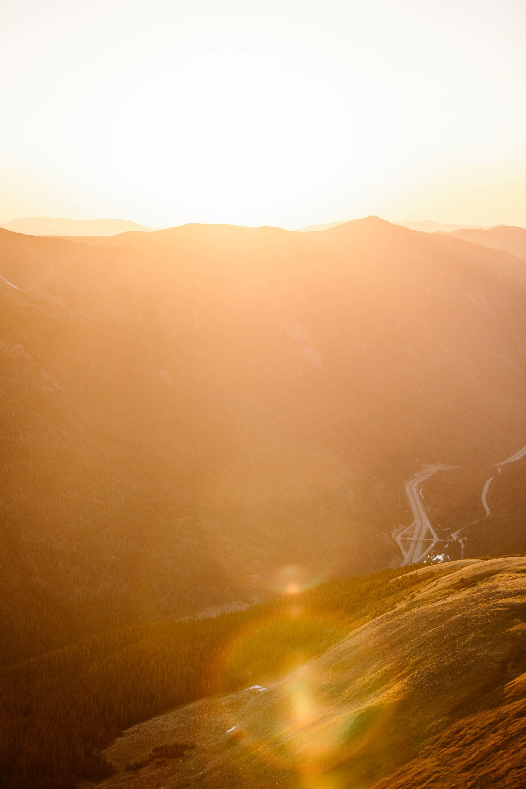
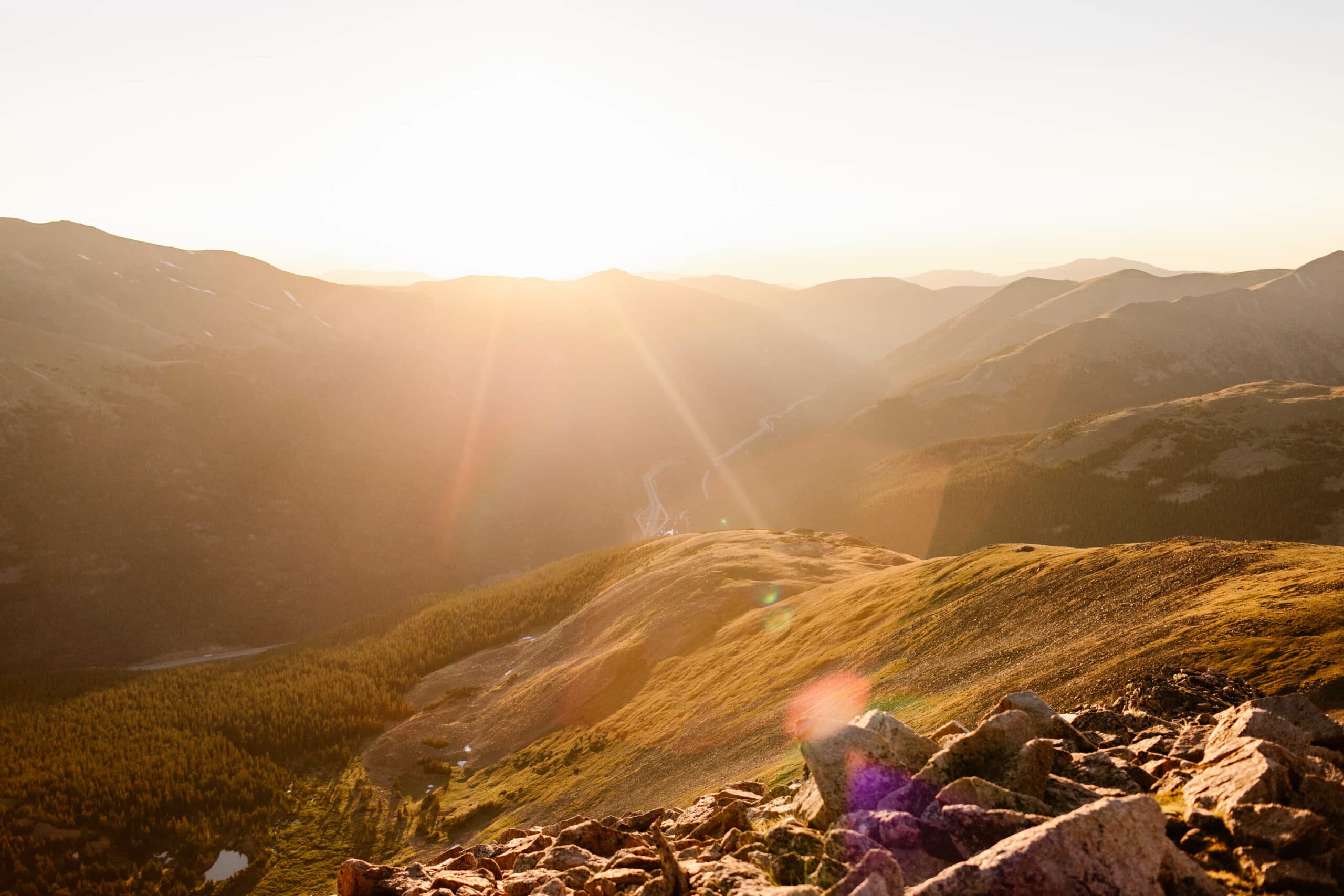
Mt Sniktau Hike Pro Tip: This trail is a DREAM at sunrise. If you’re able to get dropped off before first light to hike up and see sunrise at the summit, it’s magical. We just highly recommend being comfortable navigating high alpine trails in the dark before you do so.
The Best Season to Hike Mt Sniktau
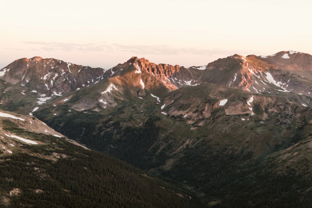
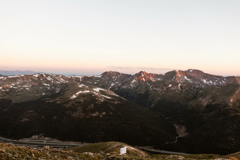
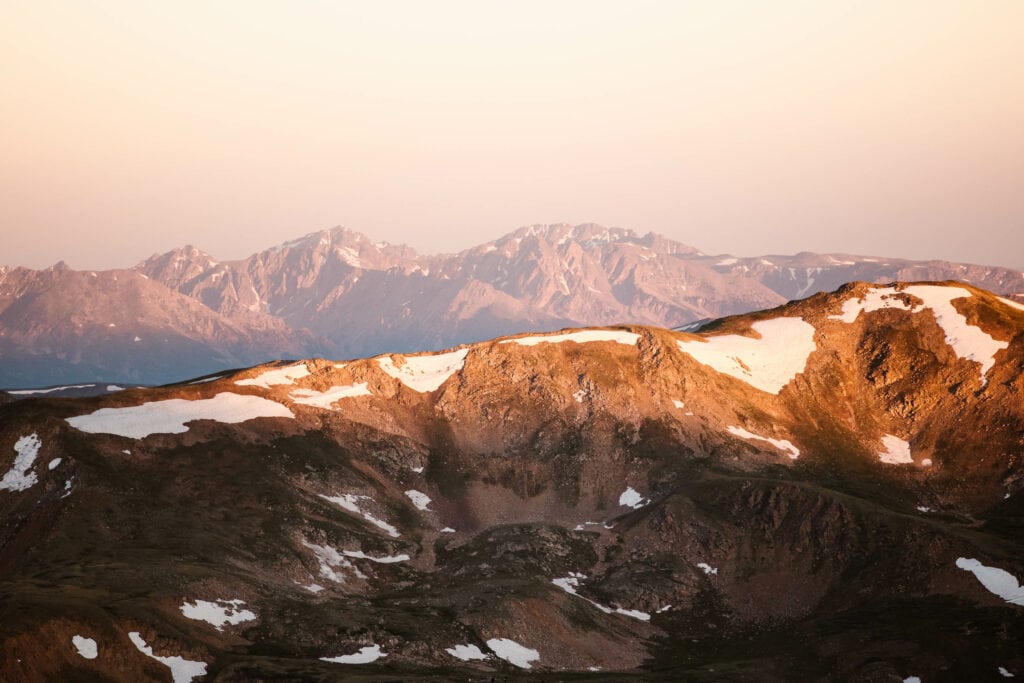
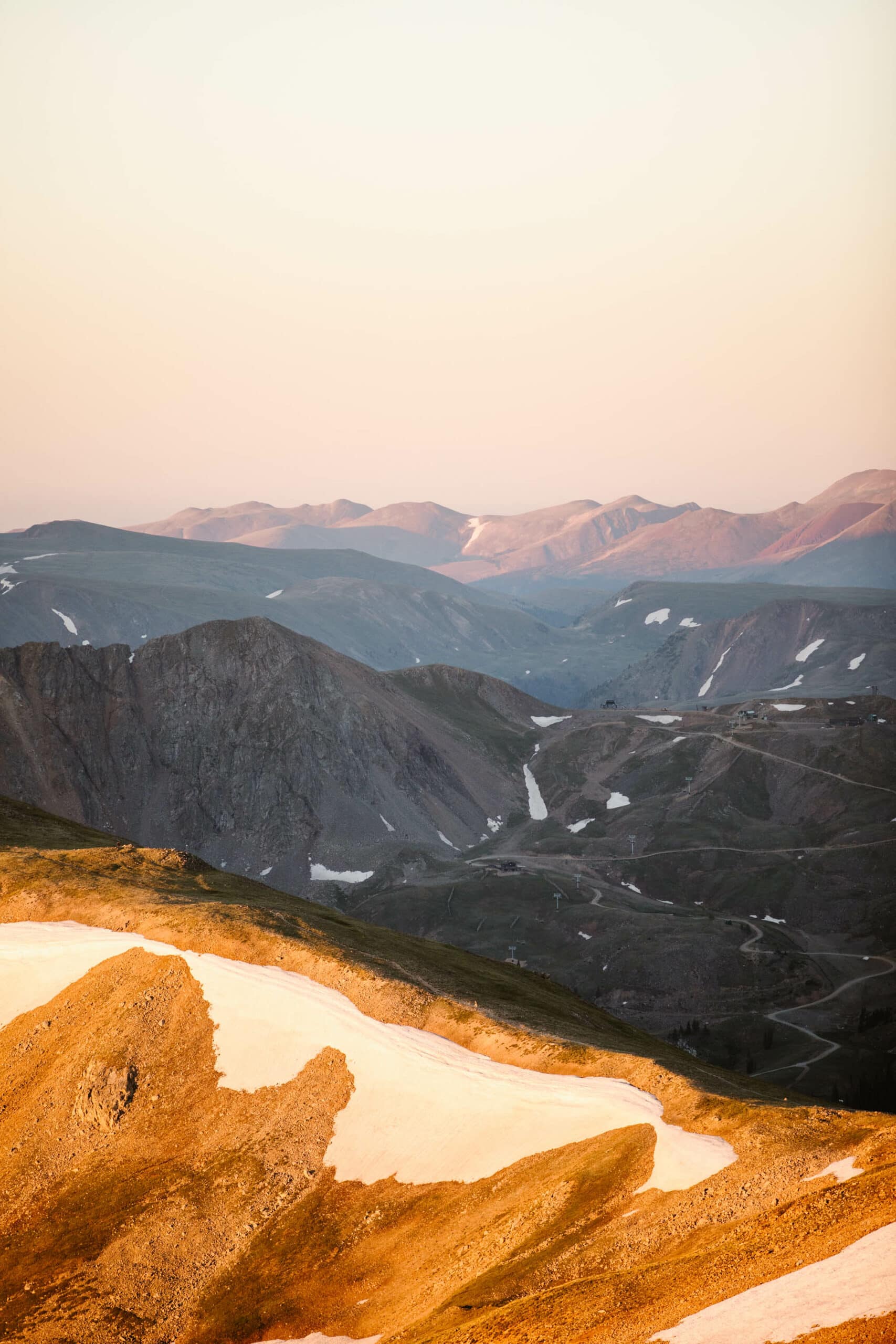
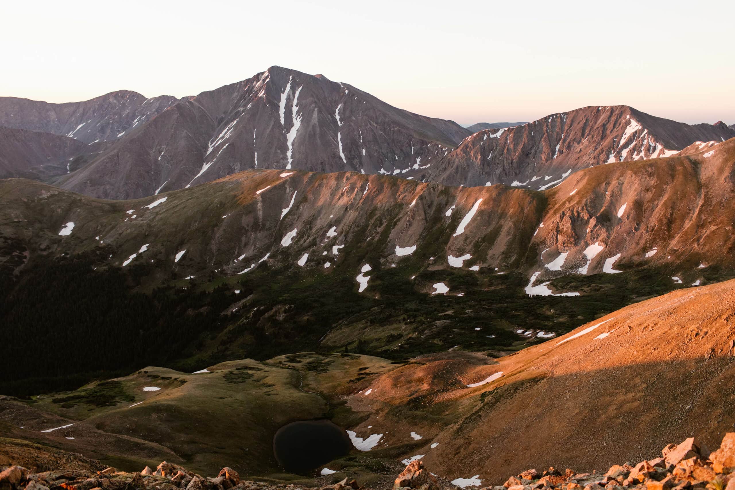
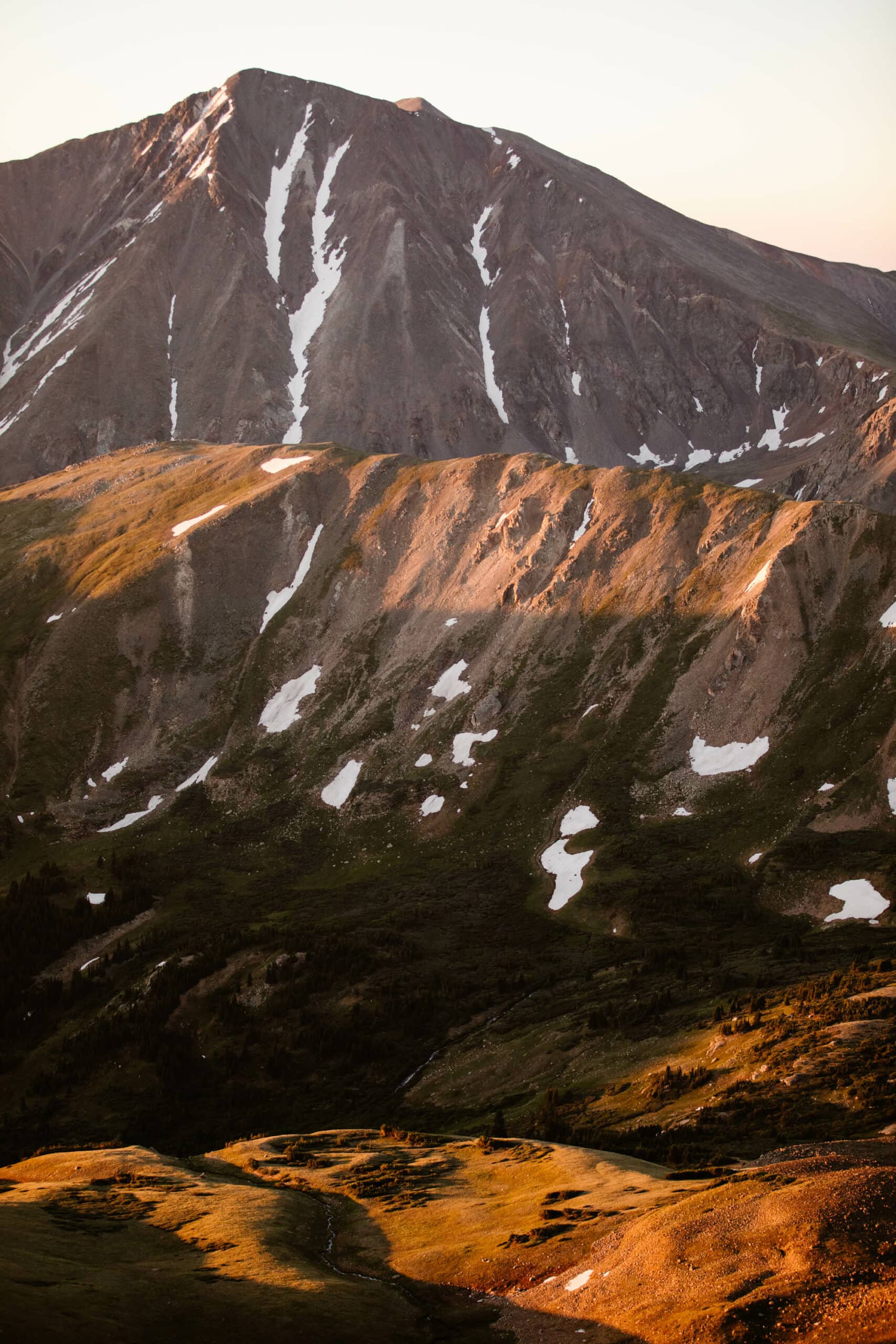
Hands-down the most enjoyable and beautiful season to do the Mt Sniktau hike is the summer. And specifically, from mid-July to mid-August, after much of the snow has melted, making the trail easier to navigate.
At this point in the year, the Mt Sniktau hike is at its most lush state, with the alpine tundra a gorgeous shade of green. For the ultimate “Sound of Music” vibes, this is when we’d advise doing this trail.
So what about the other seasons? Are they even worth considering?
As a general rule, spring in the mountains of Colorado is pretty blah. Slushy snow, thick mud from the aforementioned snowmelt, and nothing is green yet (that really doesn’t happen until very late June or early July at these elevations).
And winter? Well, the Mt Sniktau hike is already a challenge to begin with, and dealing with its steep grades + ice and snow (and the avalanche risks in this area) make this chilly season less than ideal. Sure, it’s beautiful, but you’ll have to weigh that against the wild snowstorm risks in this area.
As for fall, if you do this hike then, we’d aim for earlier in the season. But the alpine tundra has dried out at this point, and the Mt Sniktau hike isn’t known for dreamy Colorado fall colors. So you’re mostly just dealing with browned out grasses and the potential for a snowstorm to roll in at any moment.
Pro Tip: When hiking a high altitude trail like Mt Sniktau, you’ll want to be aware of the oh-so-common summer afternoon thunderstorms. Sound harmless? Think again. At this altitude and above treeline, you’re the ultimate target for lightning.
Avoid these life threatening conditions by starting your Mt Sniktau hike bright and early in the morning, when these storms are less likely. Which brings us to our next point…
The Best Times of Day (And Days of the Week) to Hike Mount Sniktau Trail
When it comes to Colorado 13’ers, the Mt Sniktau hike is definitely a busier one. It’s considered one of the less challenging of the 13’ers (although still difficult), and it’s located so close to Denver. Plus, the views are too good, so it’s no wonder it’s a frequently visited trail.
The best two ways to avoid the crowds are to do the Mt Sniktau hike on a weekday around sunrise. You’re more likely to secure a parking spot at the trailhead, and you’re also more likely to have the summit to yourselves.
Mt Sniktau Trail Conditions You Should Know About
We love reading AllTrails reviews to get others’ thoughts on our favorite hikes, but sadly, when it comes to a lot of these more challenging trails, Mt Sniktau included, the comments are littered with hikers that undersell the difficult aspects of the trail and let their egos get in the way of being genuinely truthful about conditions.
So here’s the real deal, from experienced Colorado hikers who only want you to do this trail if you’ll feel genuinely safe and comfortable on it.
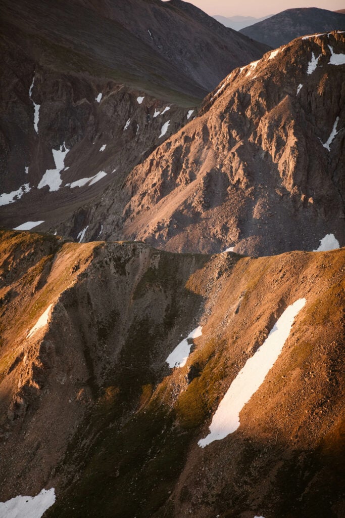
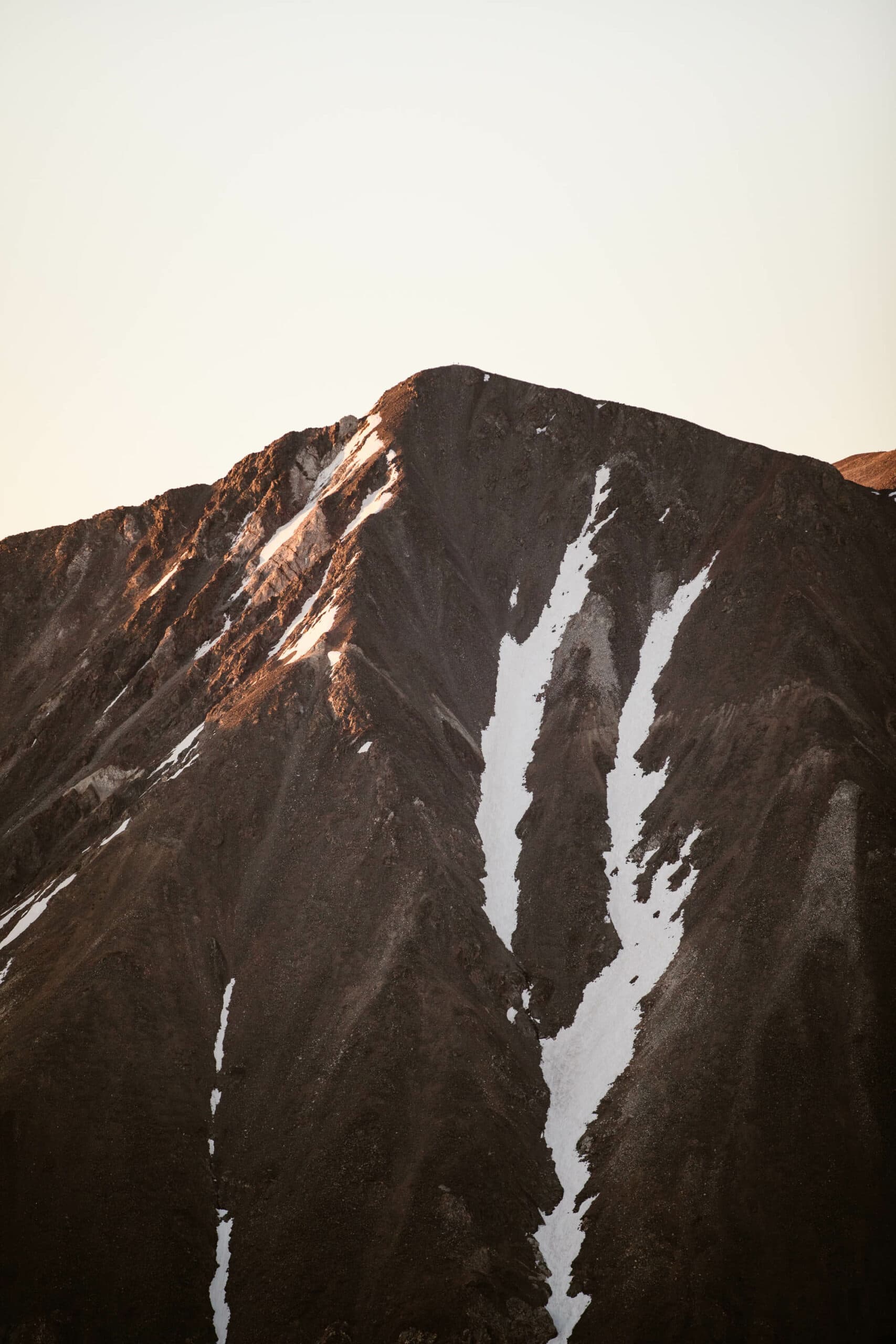
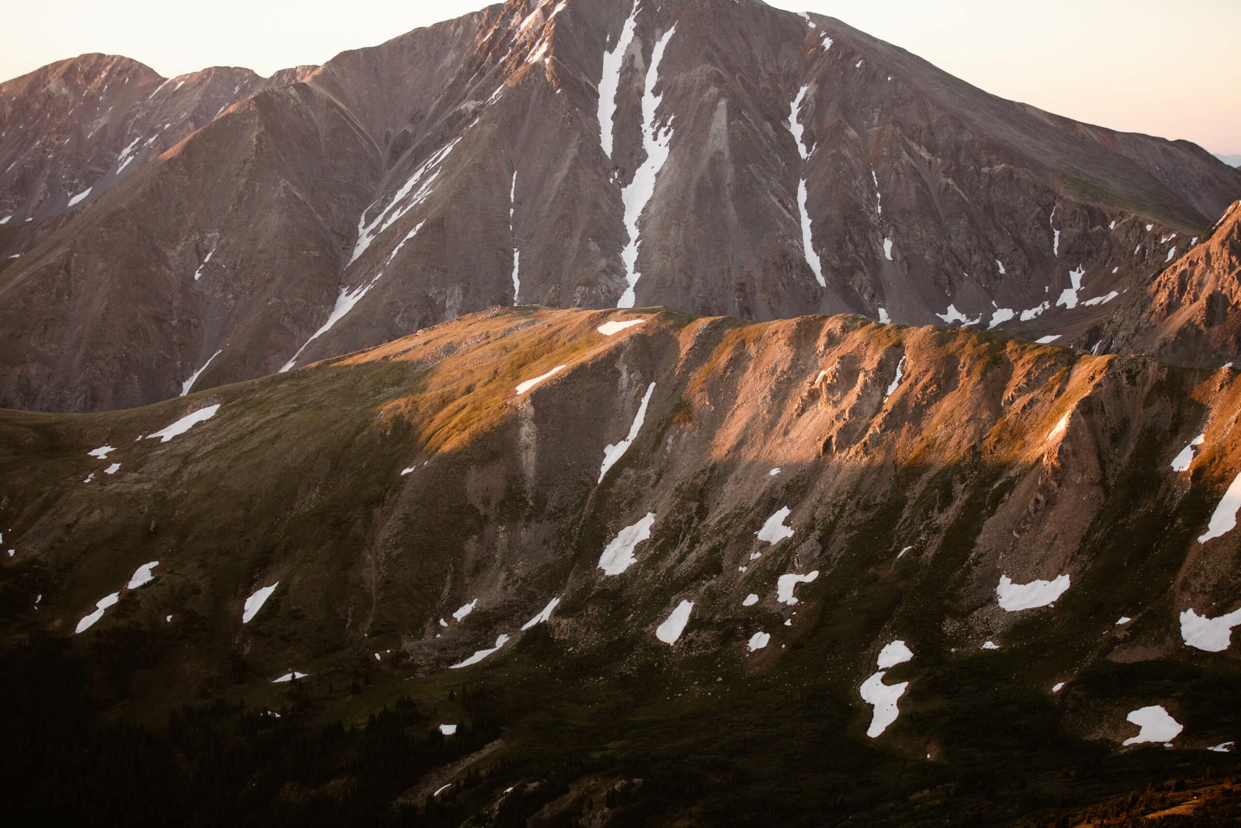
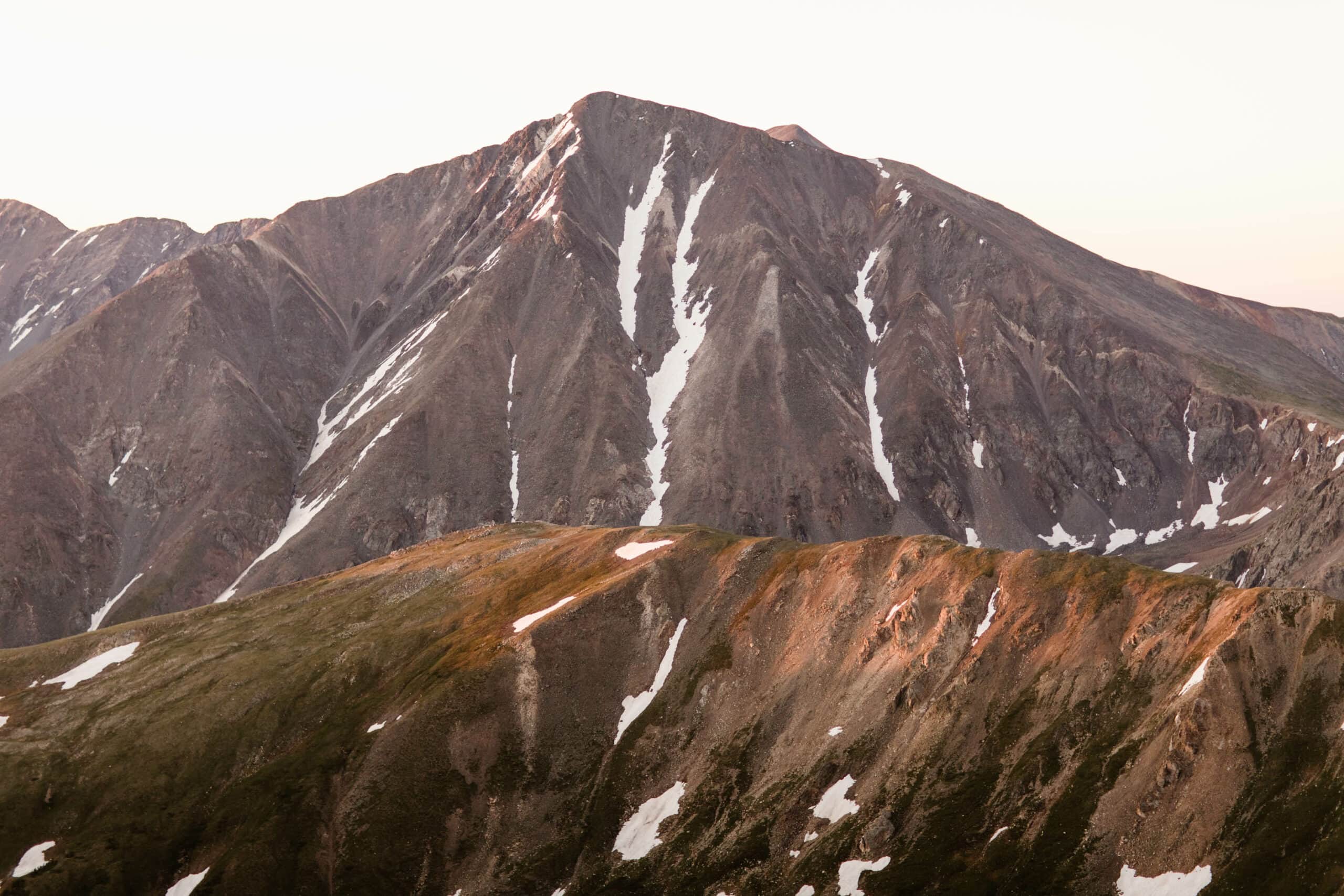
The Mt Sniktau hike is quite steep for the first mile. Genuinely, you’re hiking at what feels like a 45 degree angle, straight up, with no real breaks. And it’s all on loose and slippery sand-like rock. Not only does this make it exhausting, but it’s also quite challenging (especially on the hike down, where you’re more likely to slip).
It’s also worth noting, if you’re doing the first portion of this hike in the dark, it’s somewhat hard to identify what is trail and what isn’t, because there’s a whole section of the Mt Sniktau hiking trail that’s probably like 20 feet wide. When all you have is your headlamp to light the way, you can easily end up off trail and confused. Having the AllTrails offline map downloaded is a game-changer if you’re doing this hike before sunrise (or after sunset).
And lastly, if you have a fear of heights, just be aware that there are some steeper sections on the Mt Sniktau hike with mild rock scrambling towards the top. It can be a little nerve-wracking. One of us actually has a pretty intense fear of heights, and it helps to have a buddy who’s not as fearful to provide support and assistance during the hike.
Where to Stay When Hiking Mt Sniktau Trail
The Closest Towns to Mount Sniktau
If you’re planning on lodging near the Mt Sniktau hike trailhead, the closest town is really going to be Keystone. Other options would be Georgetown and the Dillon/Silverthorne area.
We won’t reinvent the wheel here, but we’ve written a section on our fave lodging options in this area already in our Loveland Pass guide. Since the trailhead for the Mt Sniktau hike is at the summit of the pass, all those recs still apply here. Just scroll down to the “best places to stay” section, and you’ll see a bulleted list of our top choices.
Want to Explore the Best Little Mountain Villages in Colorado?
Let’s just say we have no shortage of charming mountain towns here in CO. But not all are created equal. Our list of CO’s best mountain towns covers the ones you absolutely cannot miss.
Mt Sniktau Hike FAQ
What Amenities Are Available At the Trailhead?
To put it simply, there are no amenities at the Mt Sniktau hike trailhead. No bathrooms. No water. Just parking. So you’ll want to come prepared with everything that you need (including making that pre-hike bathroom pitstop!).
How Long Does the Mt Sniktau Hike Take?
The length of time to complete the Mt Sniktau hike will really depend on your hiking skill level and whether you’re acclimated to the high elevation.
We live in Colorado and hike frequently at very high elevations, and for us, it took about an hour and a half to get to the summit of the Mt Sniktau hike (and the same to get down). So a total of about 3 hours. However, this did include a few stops to admire the views and have some water.
If you’re less acclimated to the elevation, we’d budget for about an hour for each mile of hiking. This is a general good rule of thumb we use when recommending hikes for anyone traveling from lower elevations and exploring the high alpine.
What Else Is In The Area?
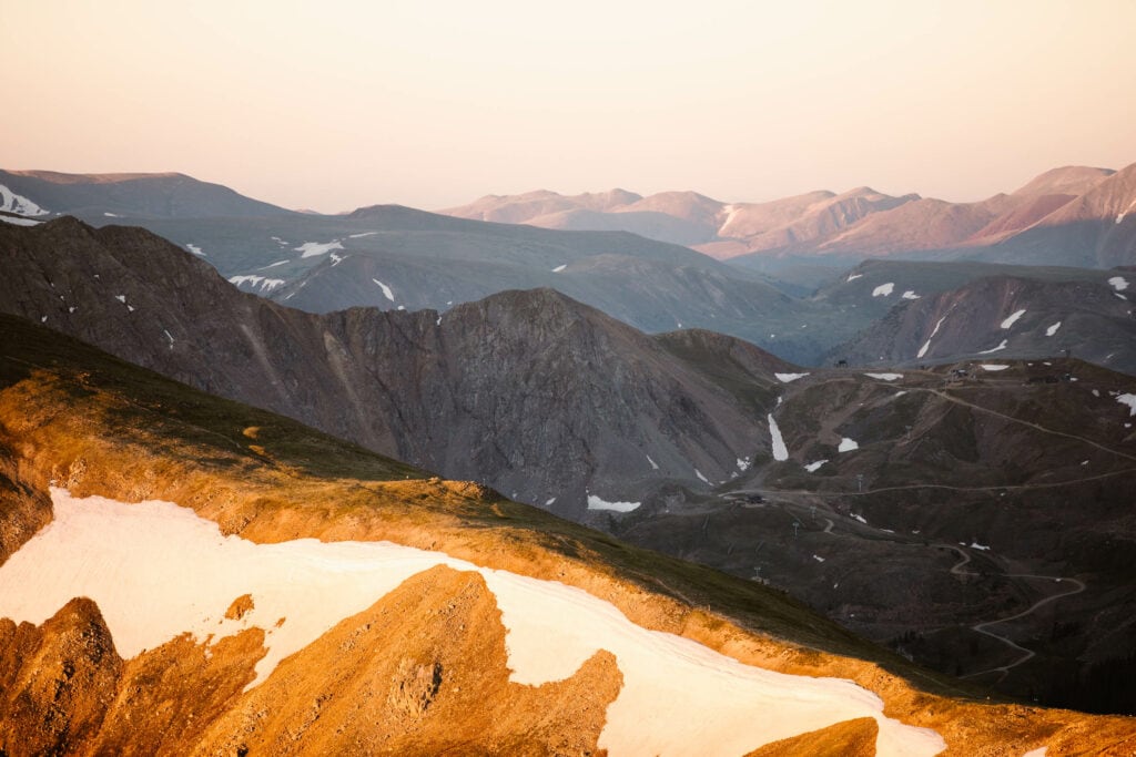
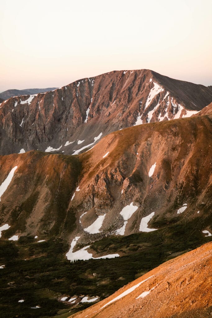
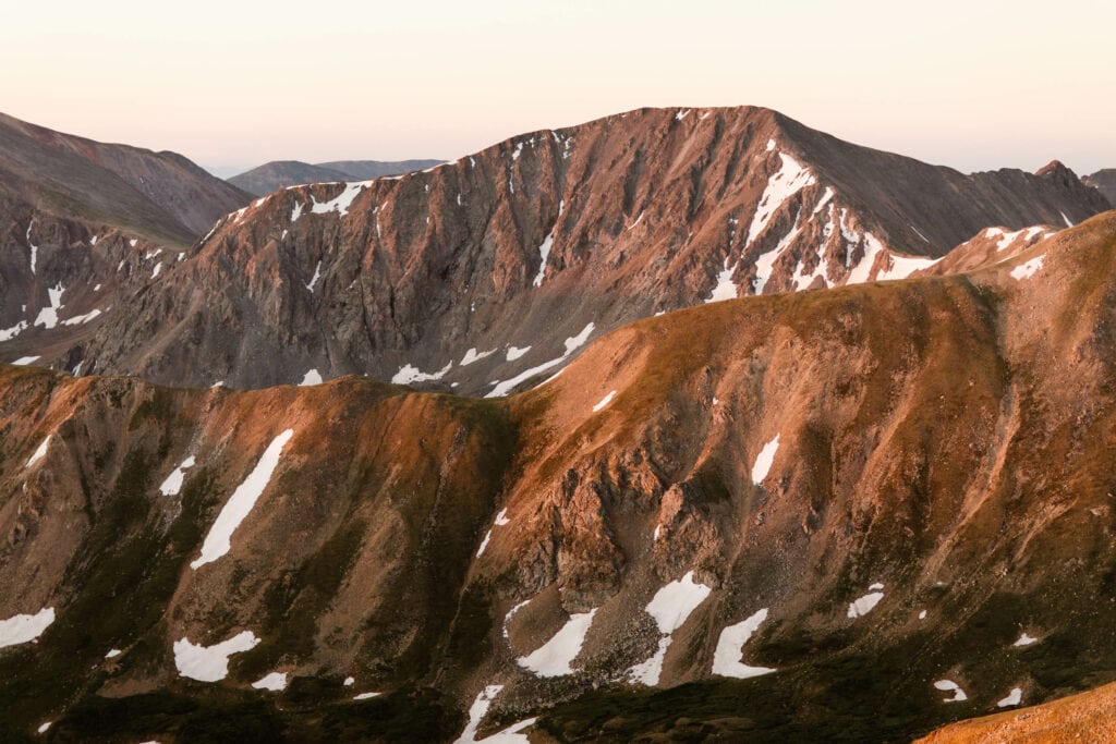
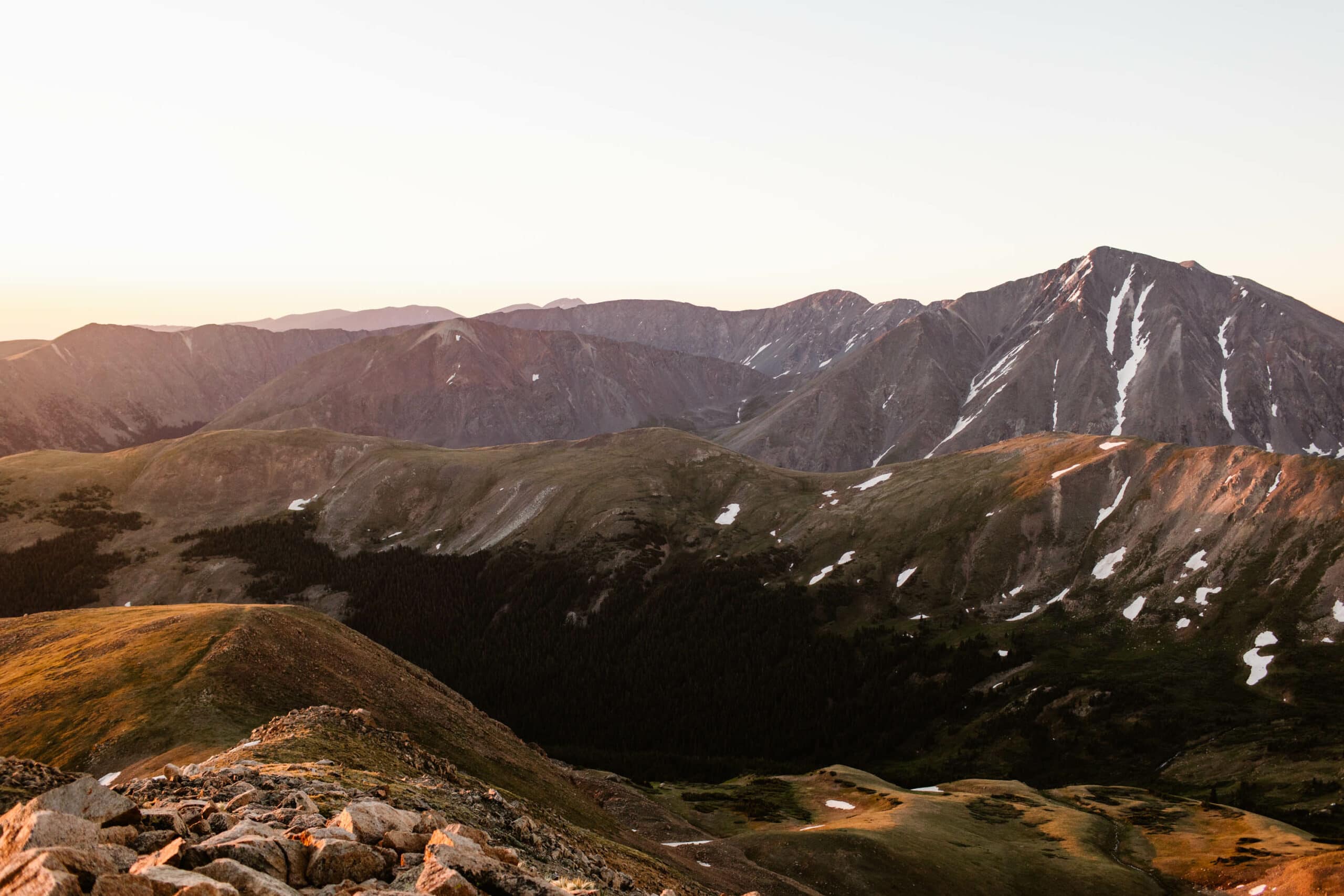
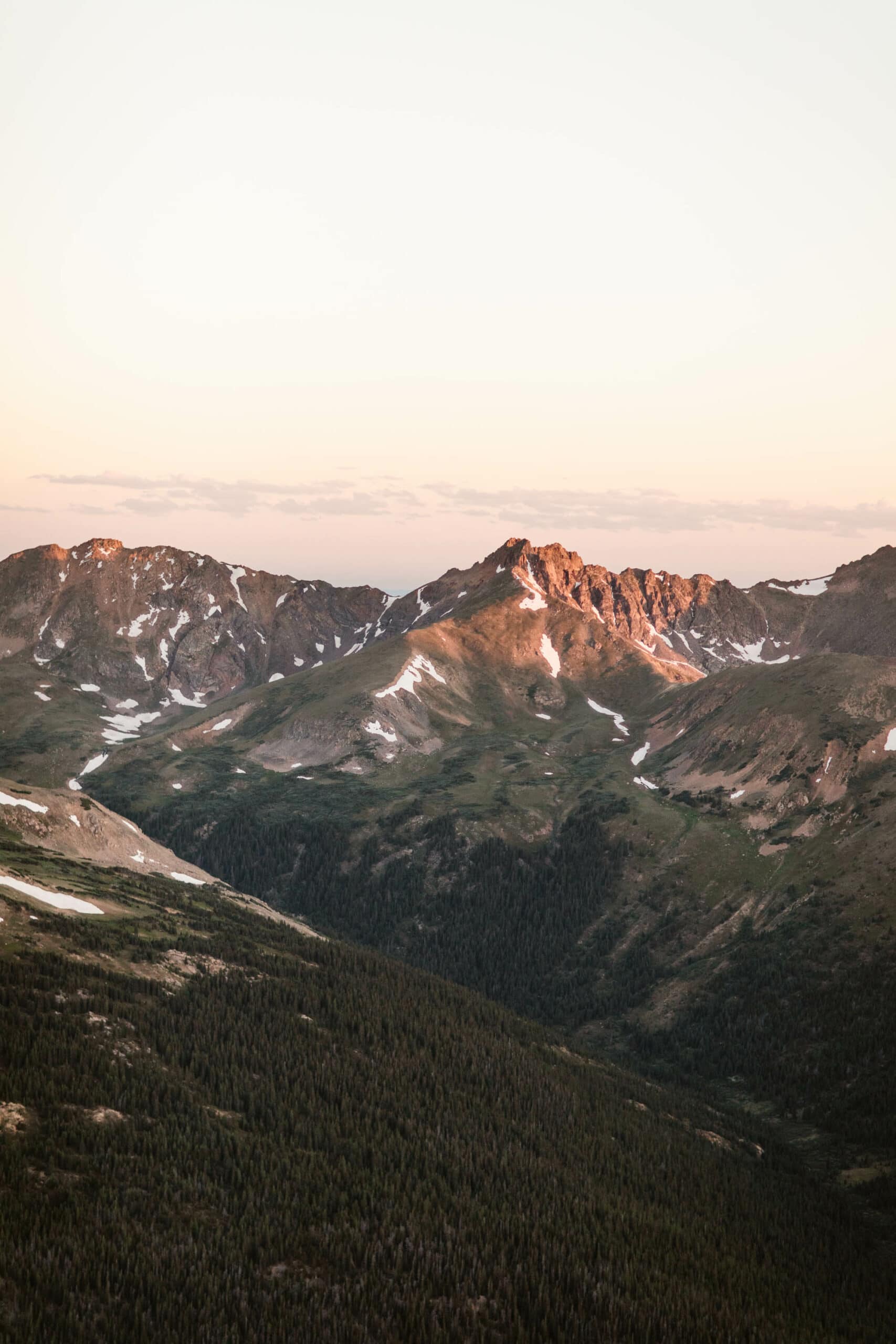
There are two other 13’ers you can access from the same trailhead as the Mt Sniktau hike: Cupid and Grizzly Peaks. Once you get past that steep first mile section, the Sniktau trail goes left and the other two peaks are to the right.
So if you want to bag three 13’ers in a single day, this is a really cool opportunity to do it.
Looking for a couple more scenic trails within an hour of the Mt Sniktau hike? These are two of our faves:
- Mayflower Gulch – home to jagged mountain peaks and cool mining cabin remains. This spot is located a little over half an hour from the Mt Sniktau hike.
- Silver Dollar Lake – a major bang for your buck hike featuring 3 dreamy high alpine lakes, located less than an hour from the Mt Sniktau hike.
Your #1 Resource To Colorado's Gems
We’re Sheena and Ed: hikers, outdoors advocates, and local Coloradans who love sharing the best our state has to offer.
Planning a visit to the Rockies soon? These are some of our favorite resources to get you started:
- Prefer road travel over everything else? Don’t miss our ultimate CO road trip itinerary.
- No idea when to book your Colorado travels? We’ve got you covered with our guide to the best travel times in the Rockies.
- Considering a move to the Centennial state? We’ve broken all down all the pros and cons of living in CO.
Sheena Shahangian Photography LLC
Empowering You To Have Your Adventure Elopement, Your Way
Colorado Elopement Photographers + Adventure Wedding Photographers