Independence Pass Colorado
The Complete Traveler's Guide (Written by Locals)
Independence Pass - A Colorado Traveler's Resource
Everything You Need to Know About Visiting + Driving Independence Pass in Colorado
Independence Pass (also referred to as CO 82) is one of Colorado’s most iconic mountain roads, and one of our personal favorite drives to do in the summer and fall months. As Colorado locals, we do this drive multiple times a year, and trust us when we say it never gets old.
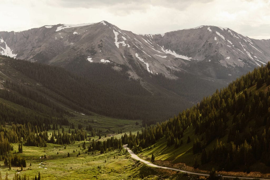
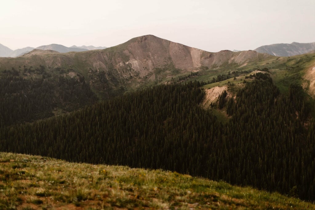
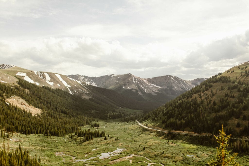
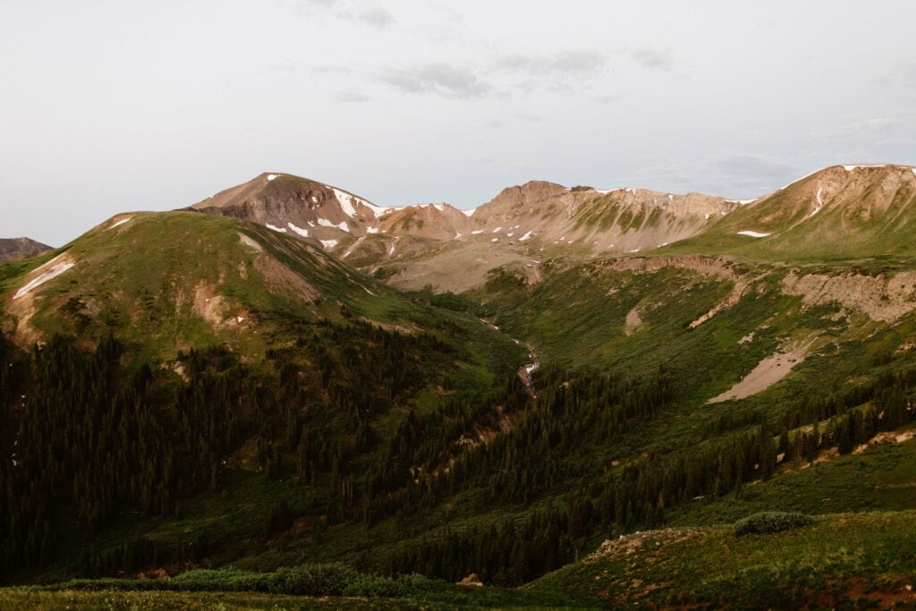
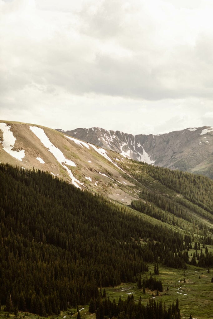
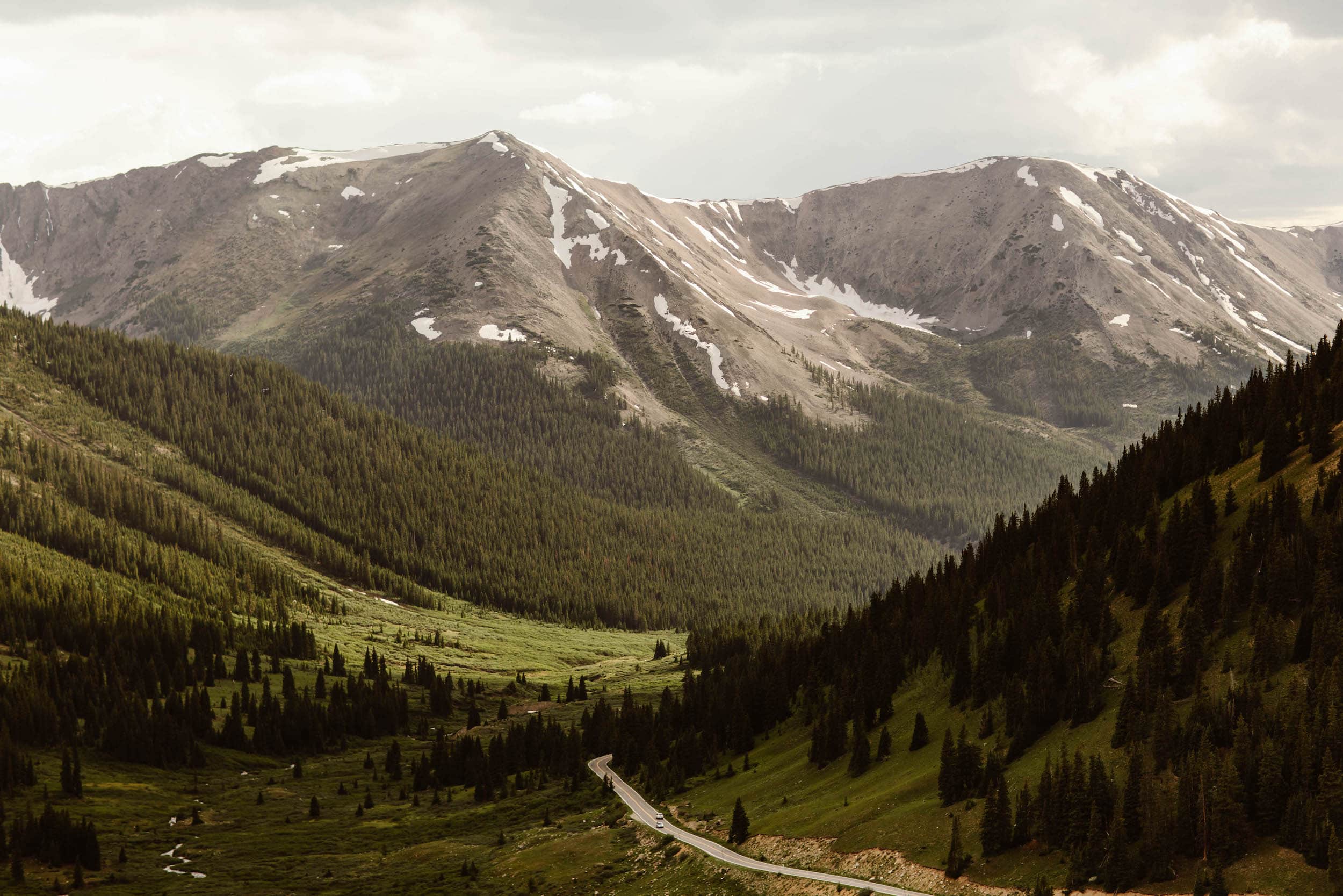
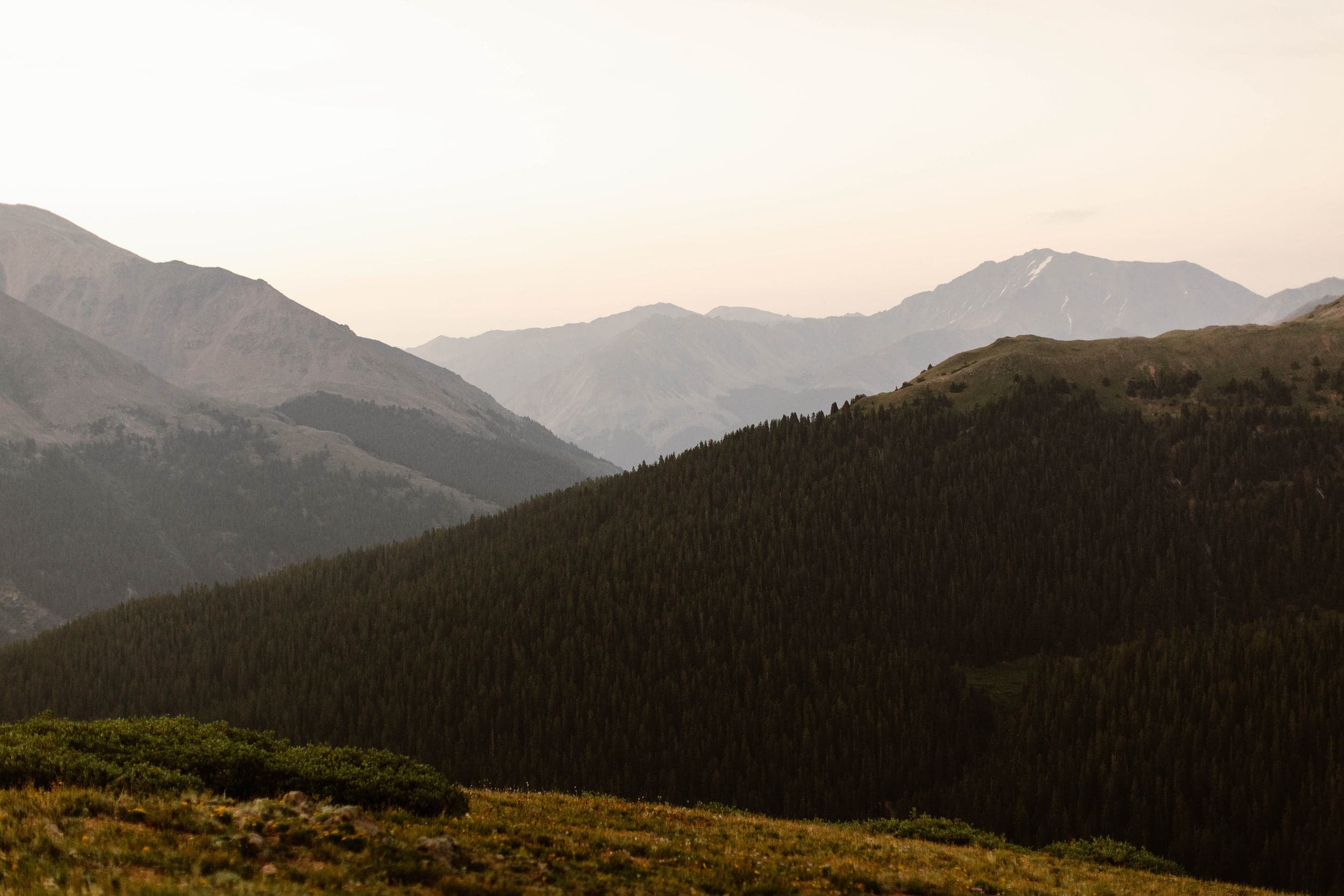
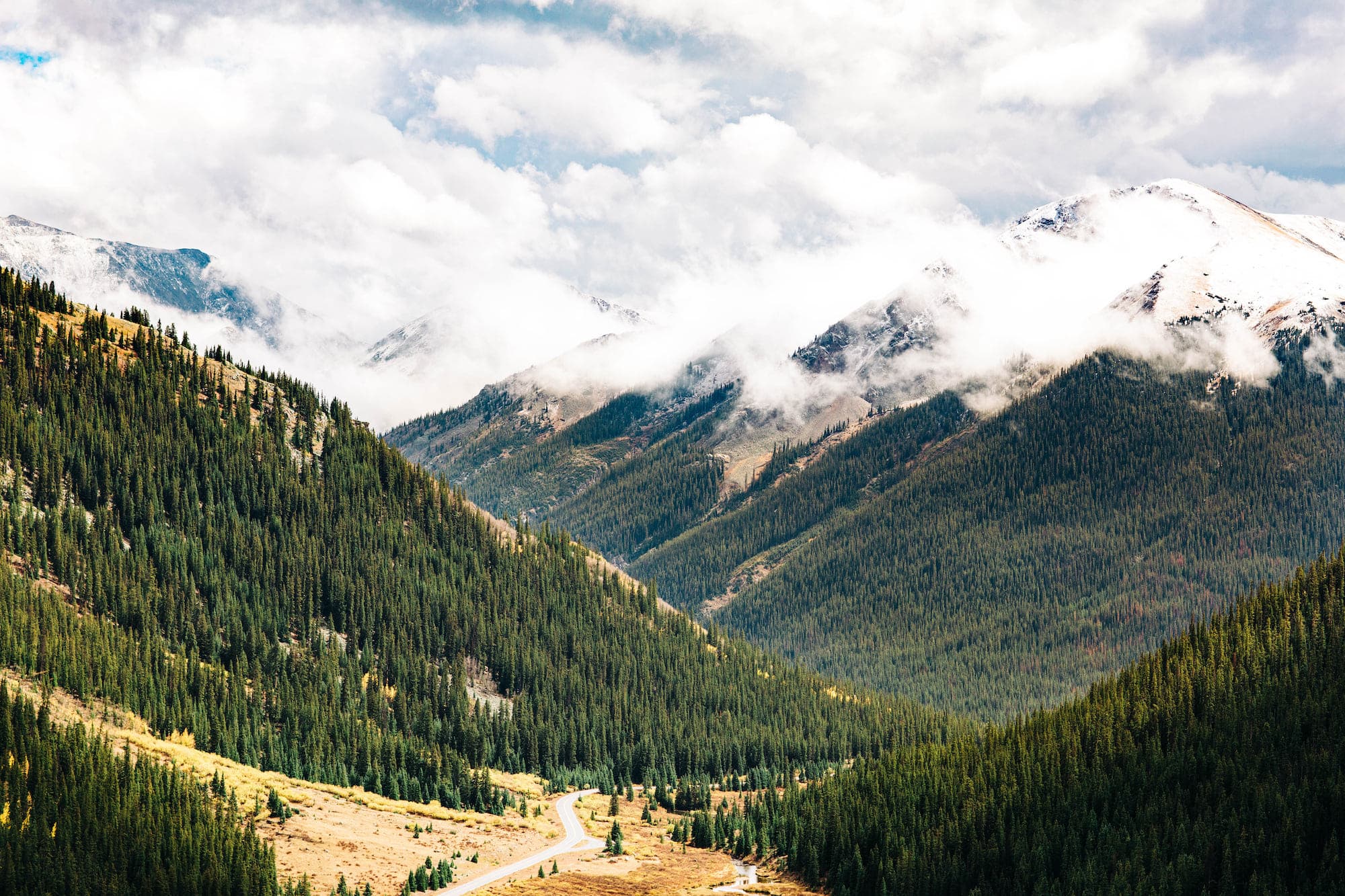
Independence Pass is a 32 mile stretch of twisting, switchback-covered road that connects the towns of Twin Lakes (on the eastern side) and Aspen, Colorado (on the western side), peaking at an elevation of 12,095 ft above sea level.
With several iconic roadside pull-offs and crazy cool hiking trails and mountain vistas, this road is a can’t-miss if you’re road tripping in the Rocky Mountains. In this guide, we’ll share all the must-know details about Independence Pass, along with our best advice for planning your travels.
And of course, we’ve included plenty of photos from the countless times we’ve driven (and hiked the trails) along Independence Pass and witnessed its sheer beauty.
We’ll also include gear recommendations for the hikes on Independence Pass, in addition to where you’ll want to book your lodging if you’re visiting from out of town.
Disclosure: We’ve included lodging and gear recommendations in this guide to Independence Pass Colorado. If you choose to book or buy through our links, we may earn a commission, at no cost to you. Shopping through these links helps support this small Colorado business. All recommendations are crafted with love and expertise, from platforms we use and trust for our own adventures.
Where is Independence Pass?
How to Get to Independence Pass Colorado
Independence Pass is a mountain pass located between the towns of Aspen and Twin Lakes in central Colorado. At the top of the pass, you’ll be at the Continental Divide, with Aspen to your west and Twin Lakes to your east.
The mountain pass straddles two counties: Pitkin County on the Aspen side and Lake County on the Twin Lakes side. Technically, the summit is on the Lake County side.
- GPS Coordinates (Top of the Pass/Continental Divide): 39.108545, -106.563980
- Nearest Towns: Aspen (to the west) and Twin Lakes (to the east)
- Independence Pass Length: 32 miles
- Independence Pass Elevation (Highest Point): 12,095 ft
- Elevation Gain: 3,454 ft
- Cell Service: none (occasional pockets closer to town, but this pass is a dead zone, so make sure to download offline maps)
When Does Independence Pass Open?
And When Does the Pass Close?
Independence Pass opens in late May (specifically, the Thursday before Memorial Day). That said, for the best weather and driving conditions, we recommend doing this drive in a more accessible and hiking-friendly month like July (more on this later).
The pass typically closes around the beginning of November, and closures will be winter weather-dependent at this point in the year. Generally speaking, though, after the fall colors end at the start of October, Independence Pass isn’t nearly as scenic and not as worth visiting.
Why Make the Trip?
Is Independence Pass Worth the Drive?
As Colorado locals, we can confidently tell you that yes, Independence Pass is absolutely worth the drive. If vast and expansive mountain views as far as the eye can see sounds good to you, you’ll find yourself right at home on this road.
Independence Pass’s location in central Colorado also puts it in close proximity to some of the best mountain towns in the state, from Buena Vista to Leadville to Aspen, and so many more. Not to mention, there are some awesome hikes along the drive.
The Best Way to Experience Independence Pass in Colorado
If you ask us, Independence Pass is best seen when incorporated into an epic road trip across our great state. As locals that live and work in the Rockies, we’ve curated an epic road trip itinerary that includes our favorite gems throughout the state.
Best Times of Year to Visit Independence Pass in Colorado
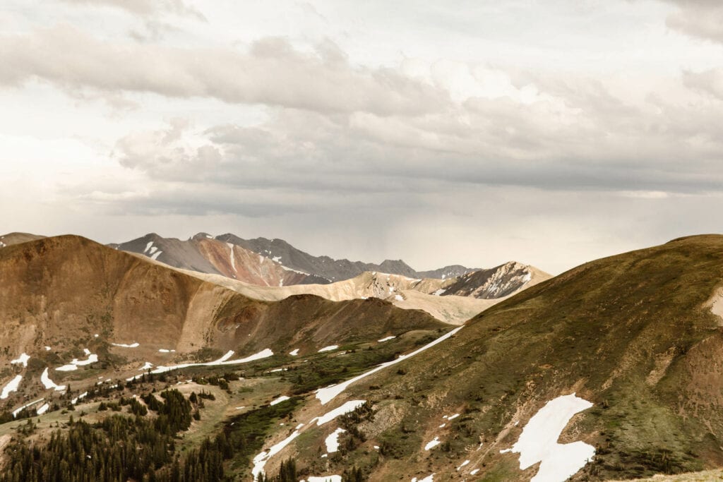
Independence Pass is actually closed for more than half of the year, due to winter weather conditions. However, during the approximately 5 months it is open, there are definitely good and bad windows for visiting.
The closer you are to late May and early June, the greater the likelihood of snowstorms rolling in at high elevations, so you’ll want to keep that in mind. If you’re not comfortable driving twisting, cliff-edged roads in the snow, we’d advise saving your trip up Independence Pass for later in the summer.
That said, visiting in early June, for example, allows you to see the tips of the mountains covered in more snow than you’d see otherwise, which can be gorgeous.
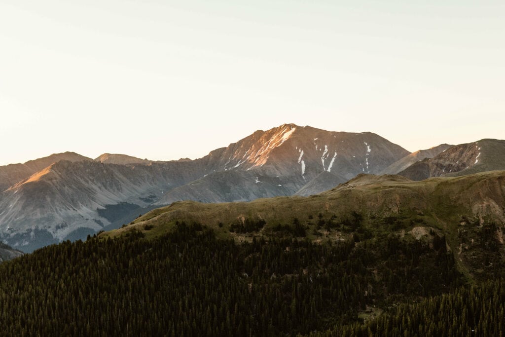
Our favorite time to drive Independence Pass is during July. Why? This is when the alpine tundra is the greenest, when many of the hiking trails are more accessible (since snowfields will be more melted at this point), and when you’ll come across alpine wildflowers.

If you’re looking to admire the fall colors, Independence Pass is one of the best places in all of Colorado to see them. Once you get below the tree line, there are tons of aspen trees on this drive, and it’s absolutely stunning. While peak fall color timing changes from year-to-year, the last week in September is generally a safe bet.
Be aware that once you get into mid-October, fall colors will pretty much be gone. And you’ll be risking snowstorms yet again. Given this, we generally don’t think it’s worth driving Independence Pass after this point.
During What Seasons Should You Plan Your Trip to Colorado (and Independence Pass)?
Not every season in Colorado is created equal, and some are definitely better than others. As Colorado locals, we’re shedding a light on the best times to plan your travels, so you know the ideal time to visit the Rockies.
Best Places to Stay When Visiting Independence Pass
The Nearest and Most Accessible Towns
While Independence Pass is sandwiched between Aspen and Twin Lakes, the town of Twin Lakes doesn’t really offer much in terms of lodging or things to do in town. If you’re looking for a place with plenty of dining and hotel options, Aspen is the go-to (with our personal favorite hotel being the iconic Hotel Jerome).
That said, Aspen can get pricey. So if you want to stay in a more budget-friendly town, our favorite is the charming little town of Leadville (which is actually the highest incorporated city in America, sitting at over 10,000 ft in elevation). Leadville is a little under 30 minutes (and a bit over 20 miles) from Twin Lakes.
Sure, you may have to drive a bit more to get to Independence Pass from Leadville, but the cost savings can make it well worth it. When it comes to awesome places to stay in Leadville, these are our favorites:
- This lovely condo in a historic Leadville building
- This gorgeous home with a rooftop hot tub that sleeps up to 8 people (for a total steal)
- This adorable little, modern tiny house.
Speaking of Charming Mountain Cities...
Let’s just say the Rocky Mountains have no shortage of adorable and adventurous mountain cities. This list includes our favorite mountain villages in the state, with some of lesser-known spots that allow you to get away from the crowds.
Independence Pass Colorado FAQs
Why is Independence Pass Scary?
For those with a fear of heights, driving Colorado’s Independence Pass can be a scary experience. This is due to the fact that parts of the mountain pass run alongside sheer cliff-sides, and some of those sections don’t have guardrails.
There also is a part of the road on the Aspen side of Independence Pass where the road becomes a single lane (but the Colorado Department of Transportation has put a stoplight in this area to reduce the risk).
Truly, Independence Pass is scariest during inclement weather. The late Spring and early Fall can see snowfall in this area, especially given the high elevation. Given that much of Independence Pass involves sharp switchbacks and sheer cliffs, snow and ice can make the drive dangerous.
It’s because of this that we personally recommend doing this drive with an AWD or 4WD vehicle. Also, you’ll want to be sure to follow the suggested speed limits on the switchbacks, many of which drop you down to 10 mph (for good reason!).
If you’re planning to drive Independence Pass in a vehicle that isn’t AWD or 4WD, we recommend ensuring you have tire chains with you. Be prepared to take things even slower in icy and snowy conditions. Slick road conditions paired with limited visibility are what can make this mountain pass a scary drive.
As a general rule, it’s also good practice to have a winter emergency kit in your car (with things like camping and hiking-friendly lightweight emergency blankets at the ready) when driving Colorado roads like Independence Pass. Yes, snowstorms can still happen in the summertime at extreme elevations.
Another thing we always bring with us when driving Colorado’s Independence Pass and hiking the trails in the area is our Garmin inReach, so we can access emergency help if we need it.
There’s no cell service on this drive, so make sure to download an offline Google Map of your route and have a device you can call for help with.
How Long Does it Take to Do Independence Pass?
To drive the full length of Independence Pass, you’re looking at around an hour to an hour and a half. But that’s without really taking much time to stop and enjoy everything the pass has to offer.
We’d recommend giving yourself at least a full day to experience some of the hikes along Independence Pass (more on those later in this guide). Get out and explore the continental divide, stop at several of the scenic roadside pull-offs, and enjoy some time in both Twin Lakes and Aspen.
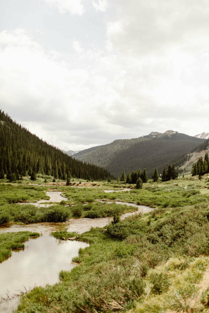
Twin Lakes is a great spot to hit up if you’re into fishing or stand up paddleboarding. And in the morning, there’s the prettiest alpenglow on the mountains that makes for a magical experience.
For these reasons, we’d recommend starting your Independence Pass excursion before sunrise on the Twin Lakes side and ending on the Aspen side with dinner in town.
Is Independence Pass in Colorado Paved?
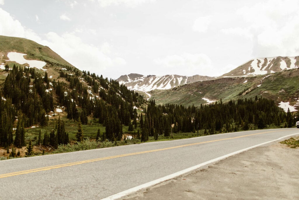
Yes, Colorado’s Independence Pass is paved, making it a very accessible driving route, even to 2WD vehicles. That said, winter weather can happen even in the summertime on this pass. So if you’re not driving an AWD or 4WD vehicle, traction devices like tire chains are highly recommended.
This stretch of road is not forgiving, and you can expect lots of twisting switchbacks and several areas with cliff-edges and limited guardrails. Like we mentioned earlier, it’s worth it to come prepared.
Psst...Planning to See Rocky Mountain National Park While in Colorado?
We live super close to Rocky Mountain NP and have visited the park countless times. From our experienced, we’ve compiled a guide to the must-see spots in the park, perfect for those who are new to the area.
Independence Pass Hikes Worth Doing
Independence Pass Overlook - Perfect for Those Iconic Mountain Views
If there’s one hike you should do when driving Independence Pass in Colorado, it’s this one. While the whole hike sits at a very high elevation of around 12,000 ft above sea level, it’s considered an easy one.
It’s only 0.4 miles round trip, and is paved (plus it’s also wheelchair accessible). If you’re exploring Independence Pass with kids, this is a great one to do, as it’s not as strenuous as some others in the area.
Leave No Trace Note: Independence Pass has several trails, including this one, that are located above tree line in what is referred to as the “alpine tundra”. When hiking in these areas, please stay on the trail at all times.
The spongy-grass-like material above tree line that makes up the tundra is extremely sensitive and can take decades to hundreds of years to grow back when trampled on.
The Grottos Trail - An Independence Pass Classic
The Grottos is definitely one of the most popular and easiest trails on Independence Pass. This one’s located on the Aspen side, about 20 minutes (less than 10 miles) outside of town. You’ll take Independence Pass east toward Twin Lakes, and the parking lot to the trailhead will be on the right side of the road.
This trail is another kid-friendly hike, at only 0.6 miles round trip (it’s a loop trail). But there’s a reason for its popularity. You’ll find rapids, waterfalls, the prettiest aqua blue waters, and caves carved by ice.
There are some spots by the Roaring Fork River that make for a perfect picnic area, too.
Pro Tip: The rocks near the waterfalls and rapids can be slick in many places, and it can make falling into the fast-running water quite dangerous. We highly recommend shoes with traction. If you’re going with sandals, something like a pair of Chaco Z1 Pro’s are known for having good traction on wet surfaces.
Independence and Lost Man Lakes - For a More Challenging Excursion
About two miles westward towards Aspen from the top of Independence Pass and the Independence Pass Overlook trail, you’ll come across the trailhead for Independence Lake and Lost Man Lake.
This is an epic above tree line trail if you’re looking to spend a good amount of time hiking and exploring, rather than dedicating all your time to driving the pass.
The trail is about 5.5 miles long, with about 1,600 ft in elevation gain. It’s technically rated as moderate, but given the very high elevation, that moderate rating really applies to hikers who are acclimated to high elevations already. If you’re not, this hike tends to lean more toward the challenging side.
That said, the views from Independence Lake and Lost Lake are quite possibly some of the best on Independence Pass. You’ll be rewarded for your efforts.
Pro Tip: It’s super easy to get sunburned when you’re above tree line, especially at this high of an elevation. I don’t burn easily at all, but have gotten burns at this elevation within an hour of being outside.
If there’s one piece of advice to take here, it’s to pack sunscreen for your Independence Pass adventures. My personal favorite brand is this one for my face (it doesn’t leave that annoying chalky residue and it doesn’t clog pores, which feels like an impossible find these days), and this sweat-resistant one from the same brand for my body (our family swears by its ability to avoid gnarly sunburns).
Staying Near Leadville and Looking for Other Awesome Hikes in the Area?
One of our favorite hikes, Clinton Gulch, is nestled between the towns of Leadville and Copper Mountain. And our article covers everything you need to know about this stunning spot. It’s a must-add to your itinerary if you’re near Independence Pass.
How to Get the Best Views (and Avoid Crowds) on Independence Pass
Colorado’s Independence Pass is one of the most iconic mountain roads in the state, which also makes it a pretty busy stop for tourists and locals alike.
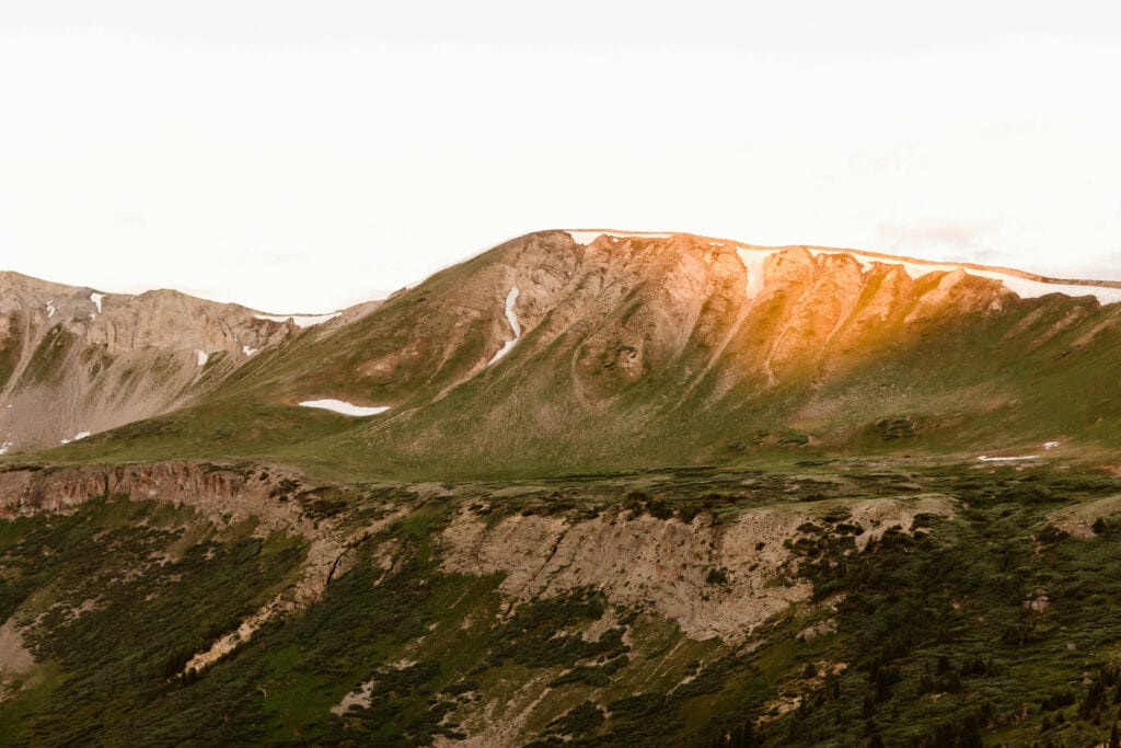
For this reason, we highly recommend driving and exploring this route on a weekday, if at all possible. Even better if you can get on the pass during sunrise. Not only are the mountains the prettiest at sunrise, but it’s the least crowded time of day.
We frequently have the summit/continental divide to ourselves when we drive Independence Pass at sunrise on weekdays, and it’s 100% worth the solitude.
It’s also worth noting, if you plan on hiking at the top of Independence Pass or above tree line at any point, you want to wrap up your hike before noon. Colorado is notorious for high altitude life-threatening lightning storms in the afternoons. Planning around sunrise is the best way to avoid them.


Traveling to Colorado? Our Resources Are Here to Help.
Sheena and Ed here! As Colorado locals, there’s nothing we love more than crafting comprehensive guides to the best parts of this state. If you’re looking to plan an epic Rocky Mountain road trip, we’ve created the perfect 2-3 week itinerary.
Can’t decide on which towns you should add to your list of stops? We’ve curated a collection of our favorite mountain villages in Colorado that you can’t miss.
Not sure what time of year to visit CO is? The seasons are finicky here, but we have a guide to walk you through the best of the best.
Planning a trip to Rocky Mountain National Park while you’re in the Rockies? We live super close to the park and visit it all the time, and these are our favorite things to do when we visit.
Sheena Shahangian Photography LLC
Empowering You To Have Your Adventure Elopement, Your Way
colorado . washington . oregon . utah . california . wyoming